

Treasures of the Orient
Orbis Veteribus Notus - D’Anville 1763
Orbis Veteribus Notus - D’Anville 1763
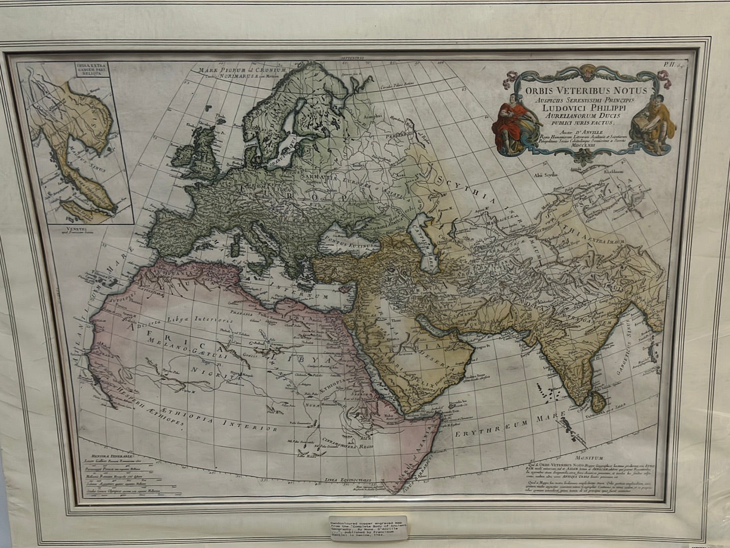
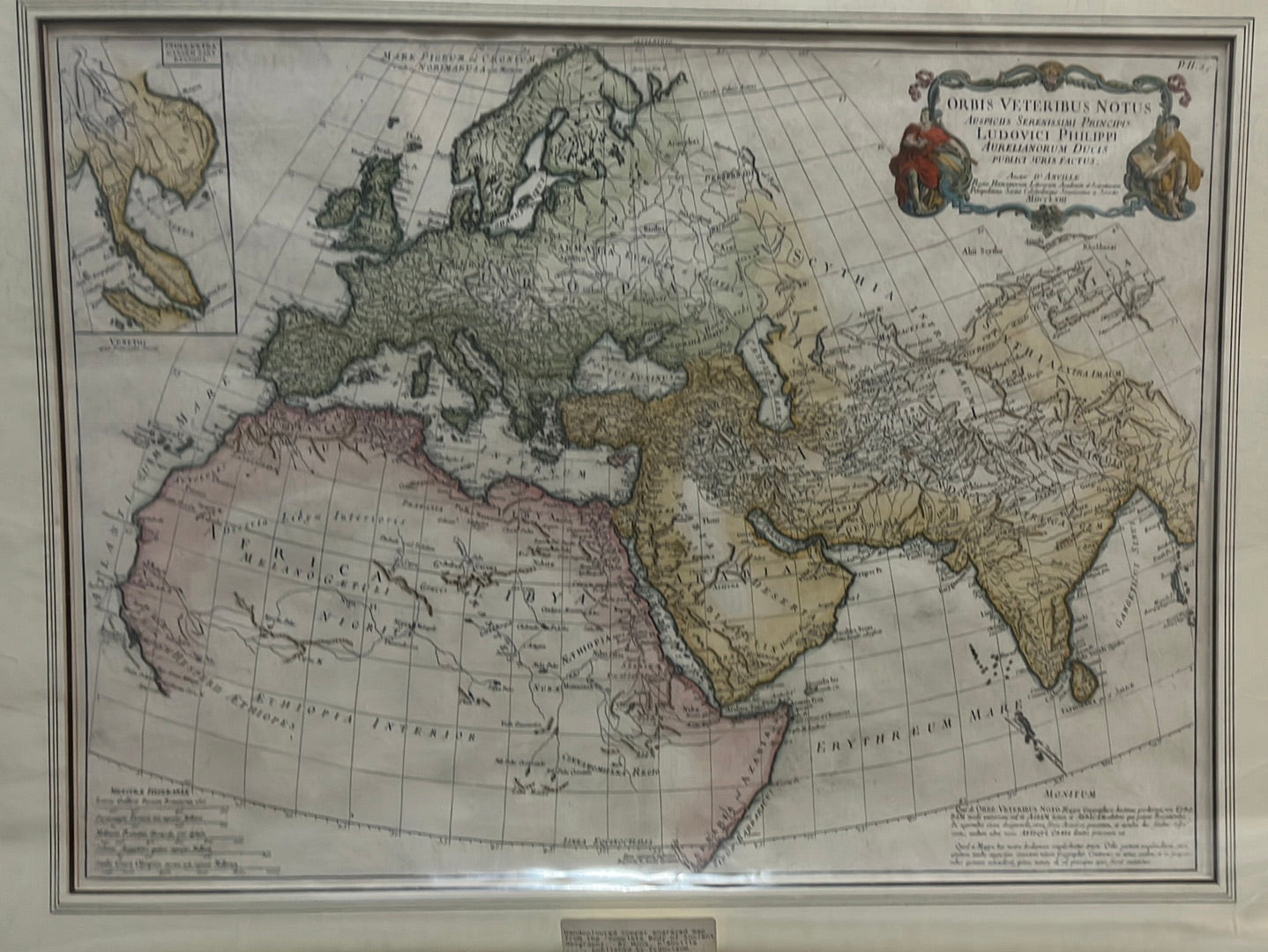
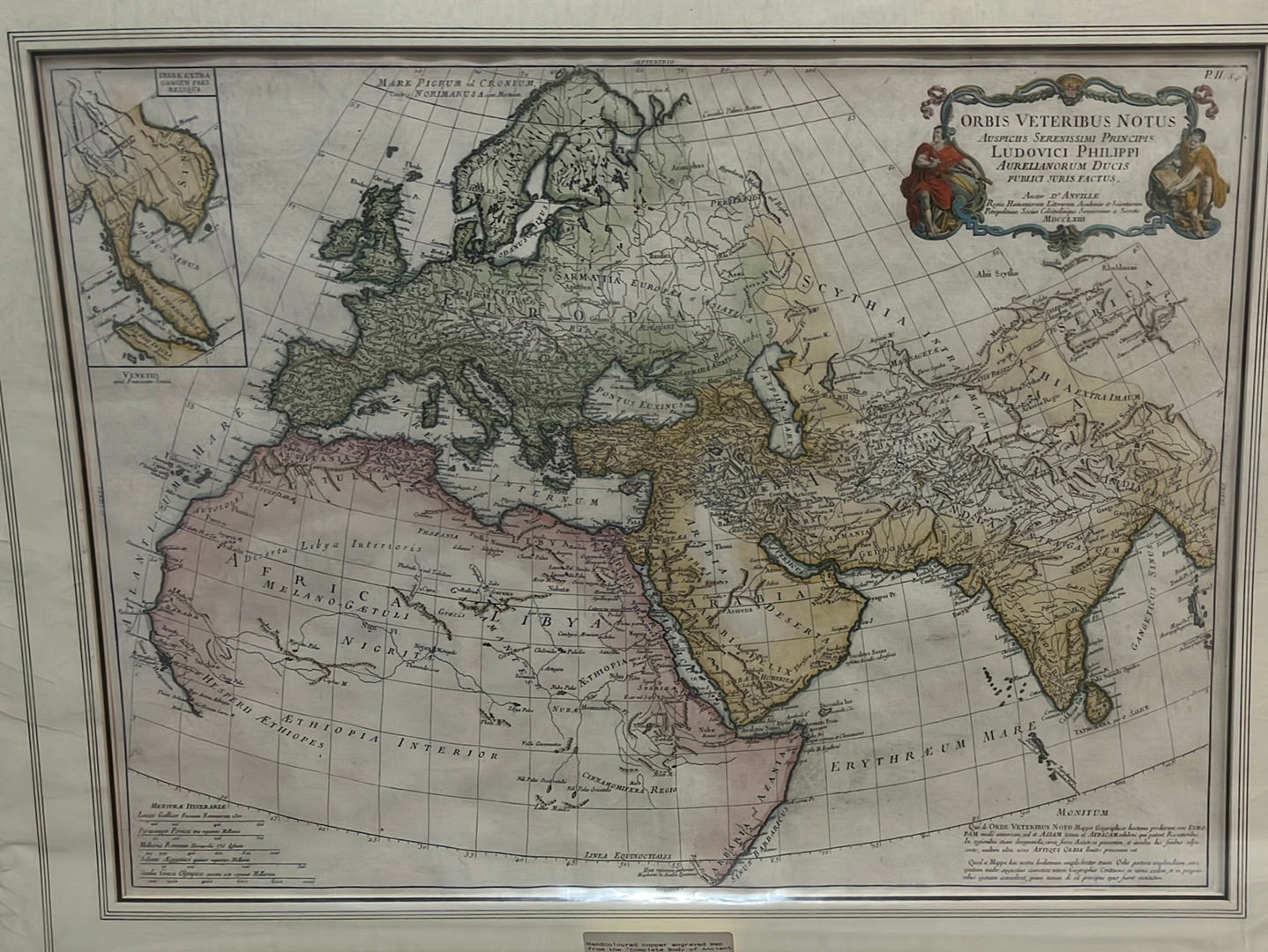
Orbis Veteribus Notus (The World Known to the Ancients)
Drawn/Published by: Jean-Baptiste Bourguignon d'Anville
Location: Paris
Year: 1763 (First published)
From: Atlas de la Géographie Ancienne
Condition: Original hand-colouring
A Masterpiece of 18th-Century Enlightenment Geography
This 1763 map by Jean-Baptiste Bourguignon d'Anville is widely considered one of the finest "comparative" maps of the 18th century. D'Anville, the premier French royal geographer, was famous for his "critical" approach—refusing to include speculative details and only mapping what could be historically or scientifically verified. This work illustrates the world as it was known to the Greeks and Romans, reconciling classical antiquity with 18th-century precision.
The "Known World" of Antiquity
The map focuses on the Ecumene (the inhabited world), spanning from the British Isles to the Far East. It meticulously identifies ancient names for regions and bodies of water:
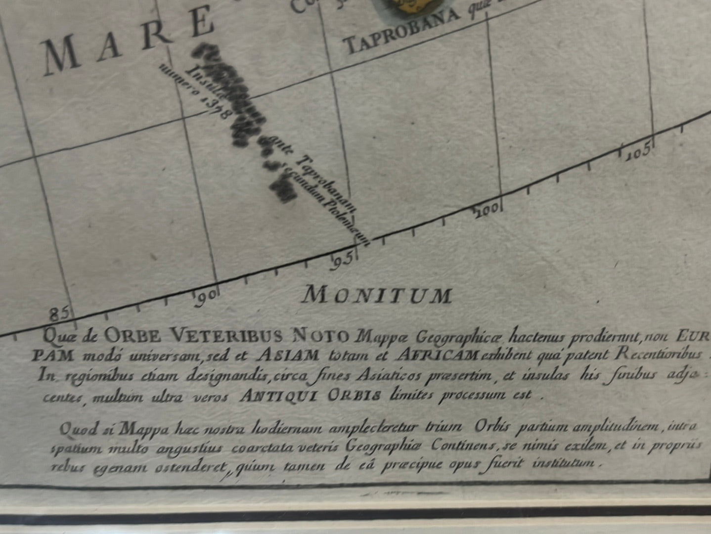
- Classical India and Scythia: The map captures the extent of Alexander the Great's eastern reaches, documenting the "Scythia" of the northern steppes and the "India intra Gangem" (India within the Ganges).
- Africa and the Nile: Central Africa is shown with the "Mountains of the Moon," which d'Anville correctly identified as the traditional source of the Nile according to the ancient geographer Ptolemy.
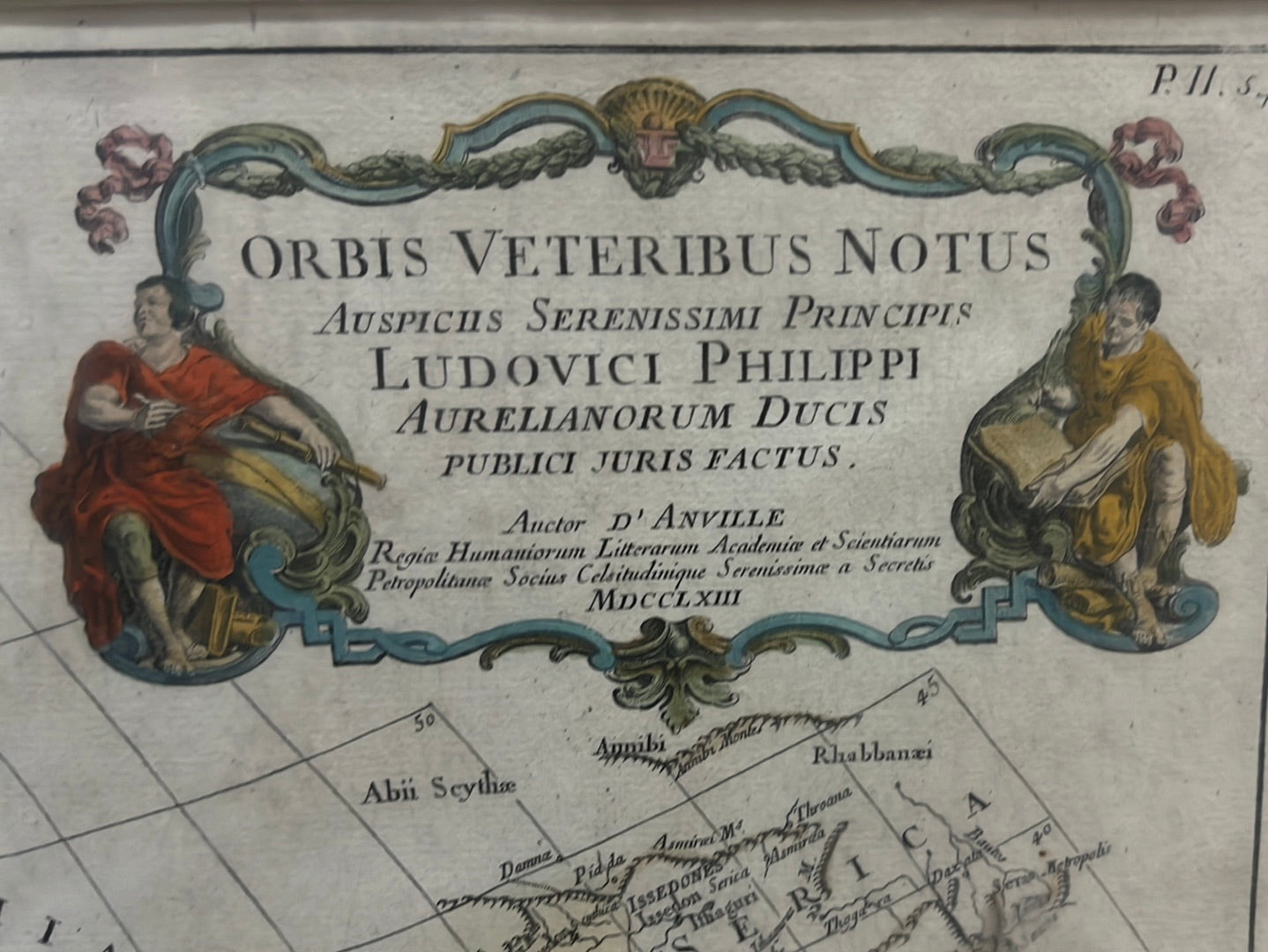
- Artistic Detail: The map is anchored by a magnificent baroque title cartouche in the upper right, featuring figures in classical drapery, and a large inset map in the upper left.
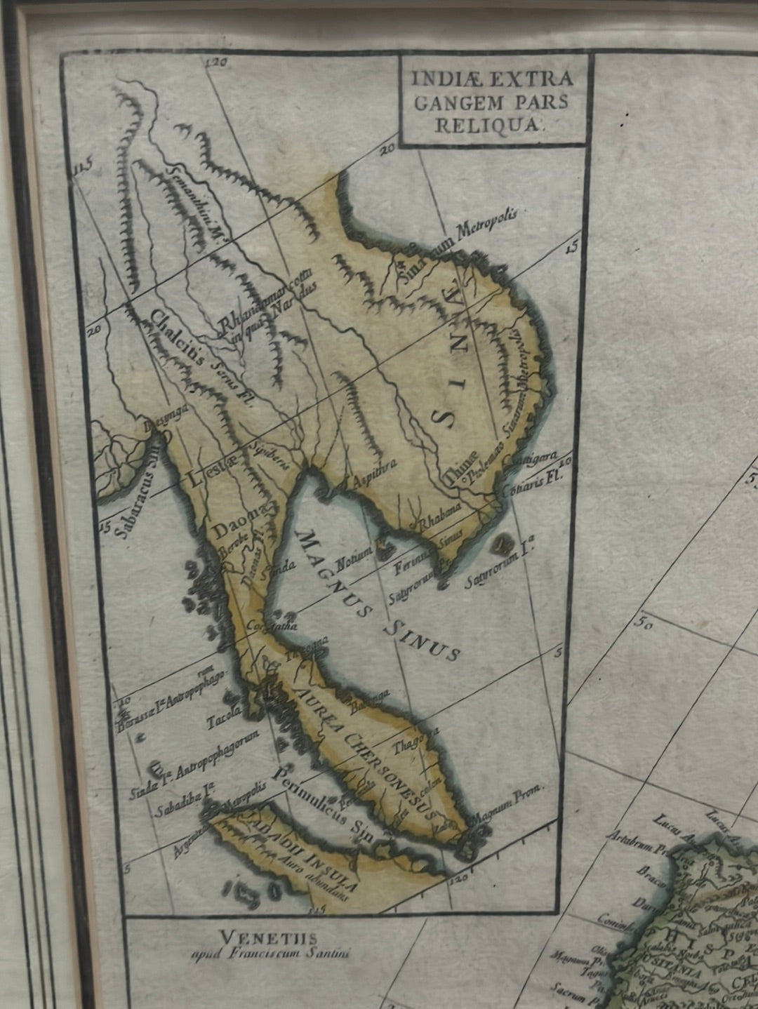
The Southeast Asian Inset
The significant inset map in the upper left corner—labeled "India extra Gangem" (India beyond the Ganges)—is of particular interest. It provides a detailed view of the Indochinese Peninsula and the Malay Archipelago as understood by the Romans. Notably, it identifies the Aurea Chersonesus (the Golden Chersonese), the classical name for the Malay Peninsula. This highlights the region’s long-standing reputation as a source of gold and trade even in the earliest centuries of maritime exploration.
A Scholar’s Legacy
D'Anville’s maps were highly prized for their clarity and lack of "geographic myths." This piece remains a cornerstone for collectors of classical history and comparative cartography, representing the exact moment when the myths of the ancient world were finally filtered through the lens of modern science.