Treasures of the Orient
Western Australia - Vandermaelen 1827
Western Australia - Vandermaelen 1827
Vandermaelen’s Map of Western Australia (1827)
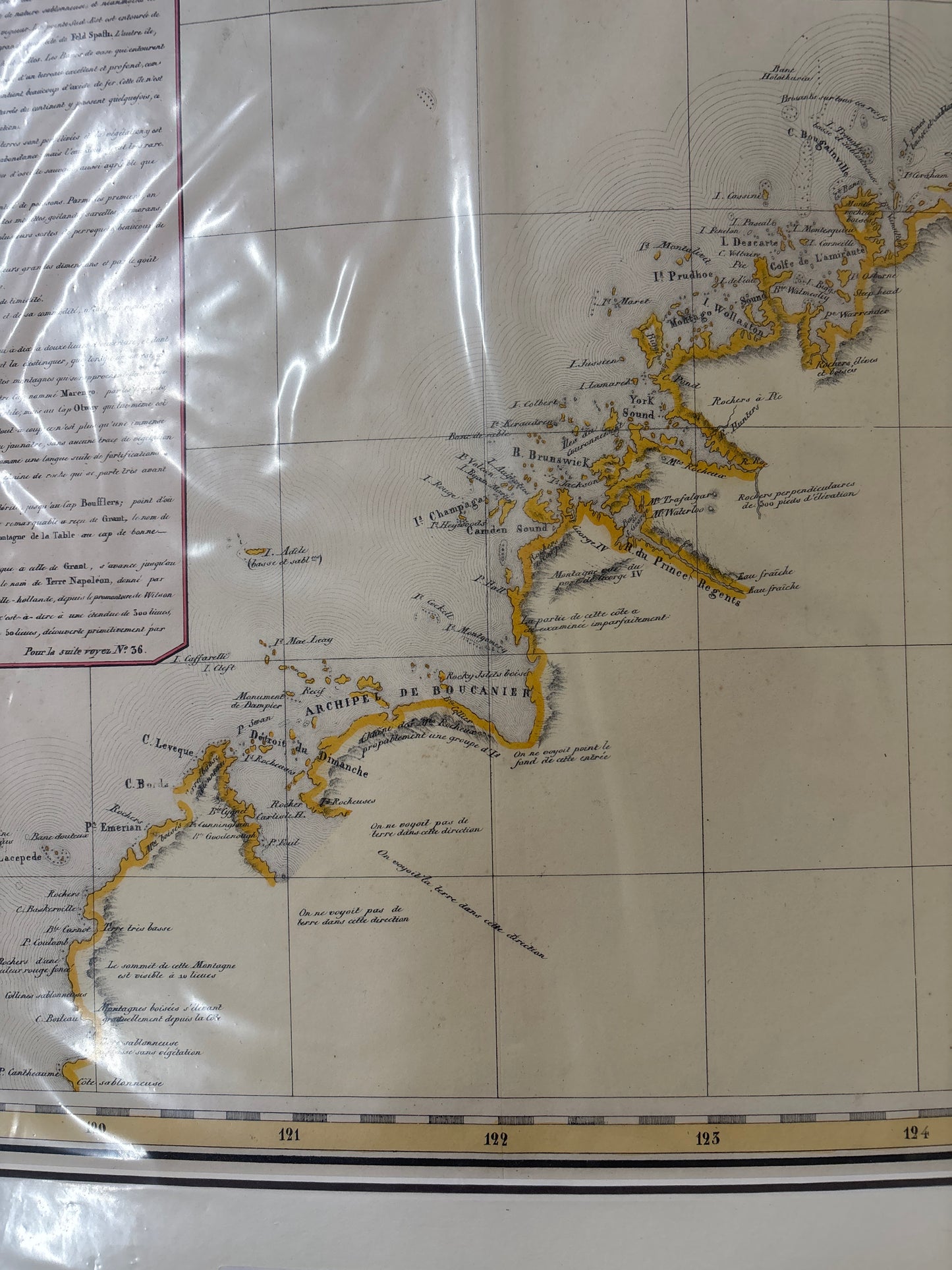
Title: Océanique. Partie de la Nlle. Hollande. No. 35. Cartographer: Philippe Marie Guillaume Vandermaelen Origin: Brussels, Belgium Date: 1827 Technique: Lithograph with original hand-colouring
The Narrative: Charting the "New Holland" Frontier
This map tells the story of the early 19th-century European fascination with the rugged, largely unexplored western coast of Australia—then known as Nouvelle Hollande. As part of the first atlas in history to be produced via lithography on a uniform scale, this sheet offers a meticulously detailed view of the Kimberley and Pilbara regions.
It captures the coastline as it was understood following the foundational surveys of explorers like Baudin and King. For the 1820s scholar, this map was the definitive scientific record of a land that remained a maritime mystery, featuring a dense "Note sur la nouvelle Hollande" that provides contemporary insights into the geography, climate, and indigenous populations of the region.
Chronicles of the Map
-
Lithographic Precision: Being a Vandermaelen production, the map features the exceptionally clear and fine-line detailing that defined the move from copper engraving to lithographic masterworks.
-
Northwestern Focus: The map spans from the Buccaneer Archipelago to Cape Londonderry, meticulously plotting reefs, islands, and coastal soundings vital for early maritime navigation.
-
Historical Commentary: The large text block in the upper left, titled "Note sur la nouvelle Hollande," serves as a valuable ethnographic and geographical record of the early 19th-century perspective on the continent.
-
Regional Nomenclature: Traditional French names such as "Terre de Baudin" appear alongside emerging British designations, reflecting the high-stakes cartographic competition for the Australian coast.