Treasures of the Orient
North West Coast of Australia - Vandermaelen 1827
North West Coast of Australia - Vandermaelen 1827
Vandermaelen’s Map of the North West Coast of Australia (1827)
Title: Océanique. Partie de la Nlle. Hollande. No. 44
Cartographer: Philippe Marie Guillaume Vandermaelen
Origin: Brussels, Belgium
Date: 1827
Technique: Lithograph with original hand-colouring
The Narrative: The Scientific Survey of the Australian Wilderness
This map tells the story of the transition from early Dutch maritime discovery to the precise scientific surveying of the early 19th century. As part of the first atlas ever produced using lithography on a uniform scale, this specific sheet (No. 44) focuses on a rugged stretch of the Western Australian coastline, historically referred to as "Witt de Witt's Land" (Terre de Witt).
It captures the shoreline as it was understood before the establishment of major colonial settlements, emphasizing the geographic features identified by French and English explorers. For the 1827 observer, this map represented the pinnacle of European data, illustrating the Dampier Archipelago and the vast, arid stretches of "Terre de Forestier" with a clarity that was revolutionary for its time.
Chronicles of the Map
-
Terre de Witt & Terre de Forestier: The map highlights significant historical regions of the Western Australian coast, using traditional nomenclature that dates back to the early maritime explorers.
-
Lithographic Detail: Being a Vandermaelen plate, the map showcases the crisp, fine-lined detailing made possible by the then-new technology of lithography.
-
The Dampier Archipelago: A detailed rendering of the Archipel de Dampier and Isles Monte-Bello is included, plotting the reefs and soundings essential for 19th-century navigation.
-
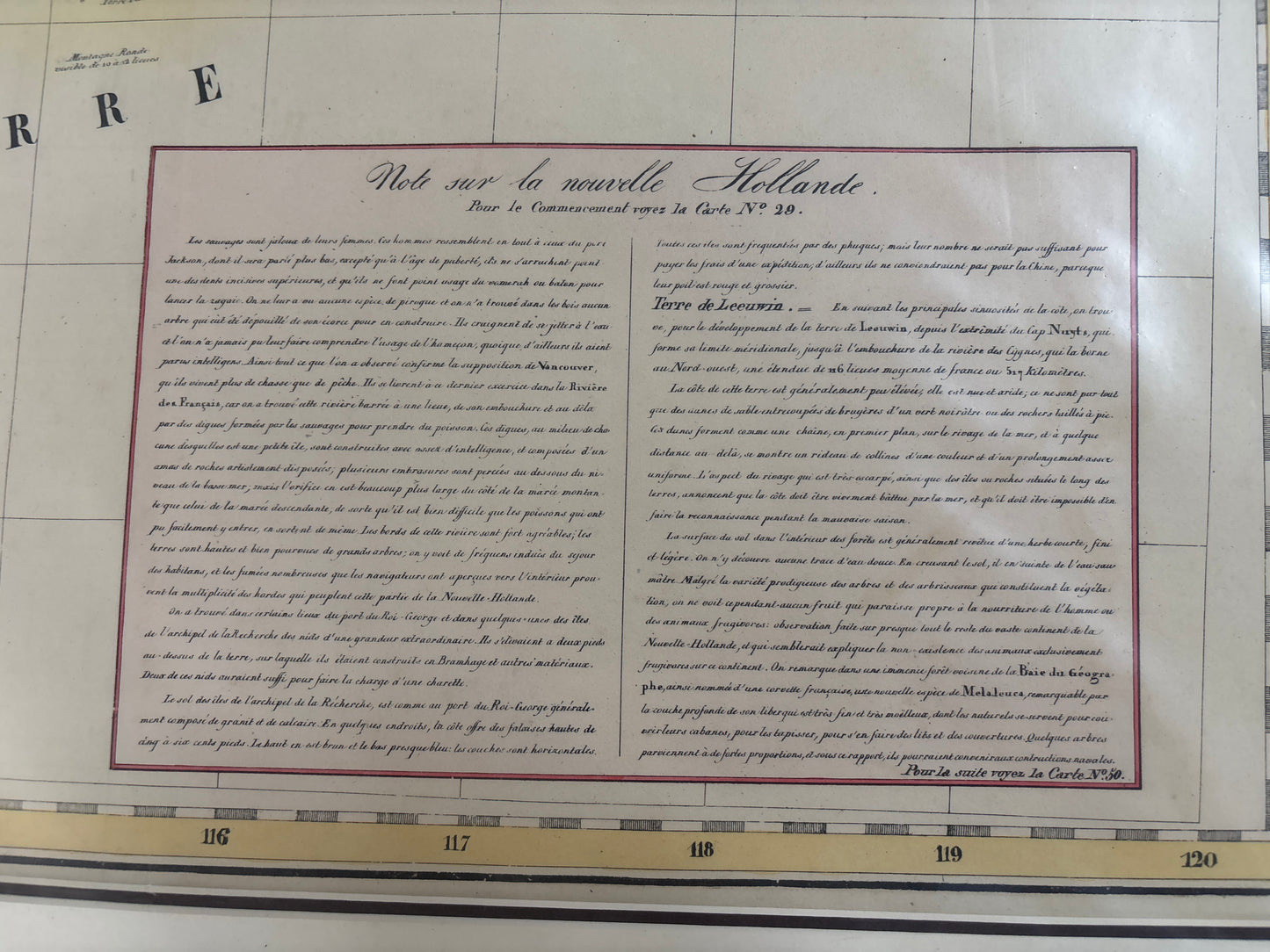
Extensive Cartographic Commentary: A large text block titled "Note sur la nouvelle Hollande" provides a contemporary analysis of the continent's geography, indigenous populations, and the history of its discovery by Baudin and King.