
Treasures of the Orient
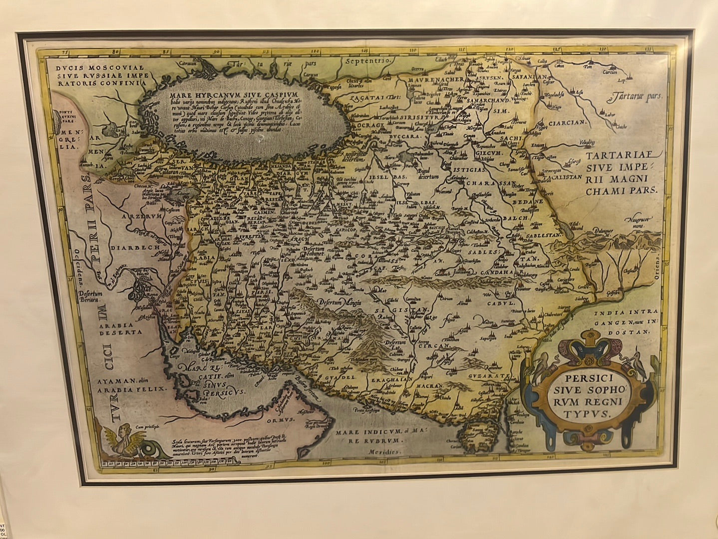
Ortelius’s Map of the Persian Empire (c.1570)
Ortelius’s Map of the Persian Empire (c.1570)
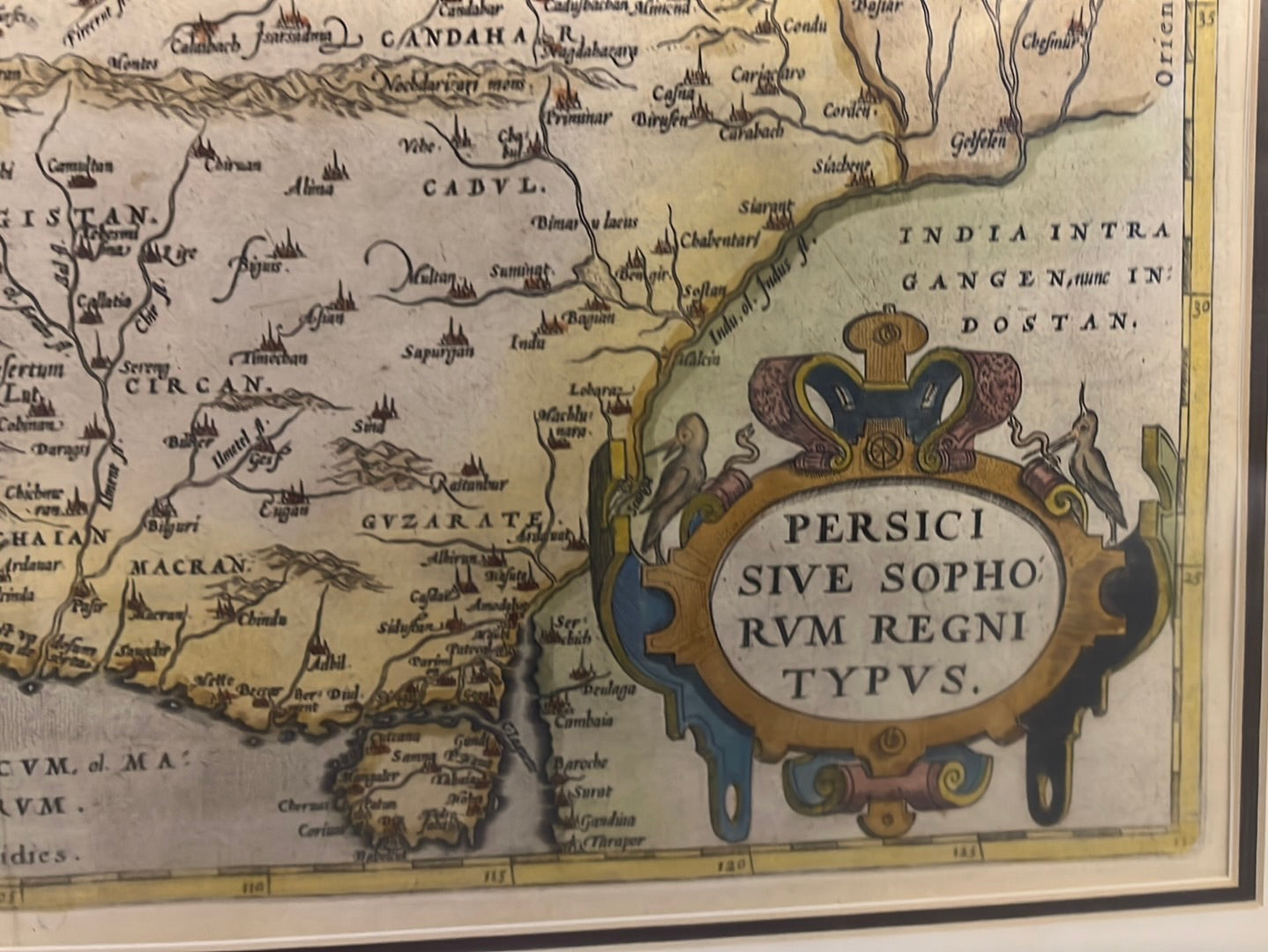
Title: Persici Sive Sophorum Regni Typus
Cartographer: Abraham Ortelius
Origin: Antwerp, Belgium
Date: c. 1570
Technique: Copperplate engraving with hand-colouring
The Narrative: The Renaissance View of the Safavid Empire
In the mid-16th century, the Safavid Empire of Persia was a major global power, a bridge between the expanding Ottoman Empire to the west and the Mughal Empire to the east. This map, created by the renowned Abraham Ortelius for his landmark atlas Theatrum Orbis Terrarum, tells the story of how Europe visualized this distant, sophisticated realm. It is a map of high Renaissance drama, filled with decorative details and the best geographic knowledge of the day.
The map captures a Persia of grand cities and formidable geography. Ortelius relied on the accounts of travelers and the classical texts of antiquity to piece together this view. It presents the empire not just as a political entity, but as a crossroads of cultures and a center of legendary wealth and learning.
Chronicles of the Map
-
The "Father of the Modern Atlas": As one of the centerpieces of Ortelius’s Theatrum, this map was part of the first systematic collection of maps of the world, a work that revolutionized how Europeans perceived their planet.
-
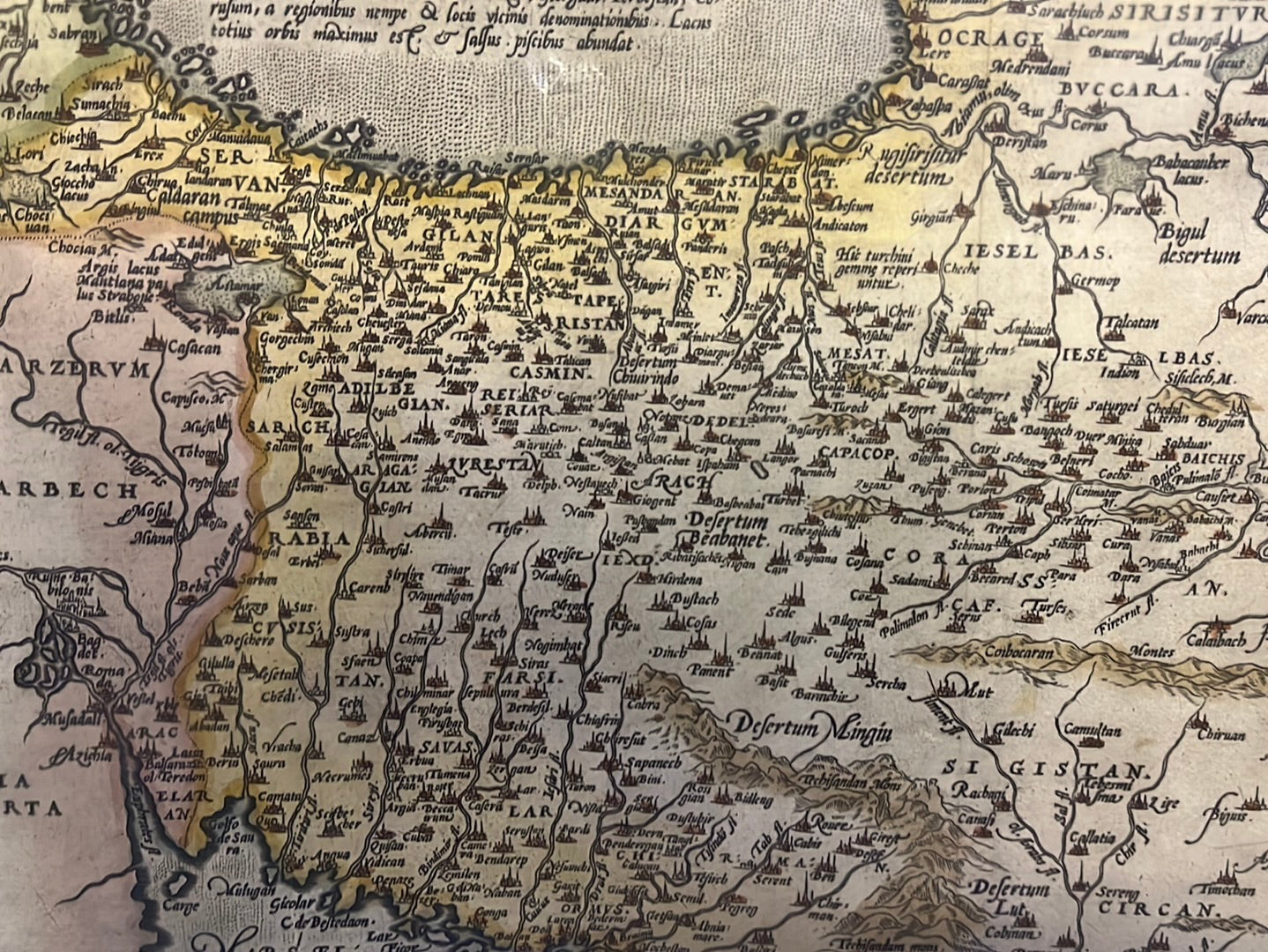
A Landscape of Cities: The map is dotted with miniature architectural icons representing major cities like Isfahan, Tabriz, and Hormuz, illustrating the urbanized nature of the Persian Empire.
-
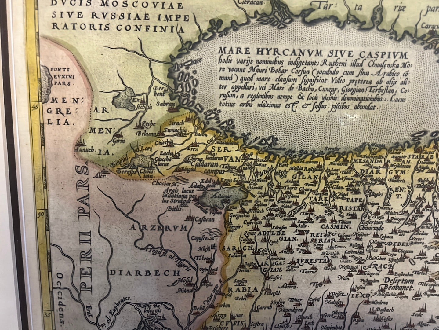
The Caspian Sea: The sea is prominently featured in the upper left, shown with the archaic, slightly rectangular shape common in 16th-century cartography.
-
Renaissance Decoration: The title is housed in a magnificent, highly ornate cartouche in the lower right, complete with classical motifs and elegant strapwork, a signature of the Antwerp school.