Treasures of the Orient
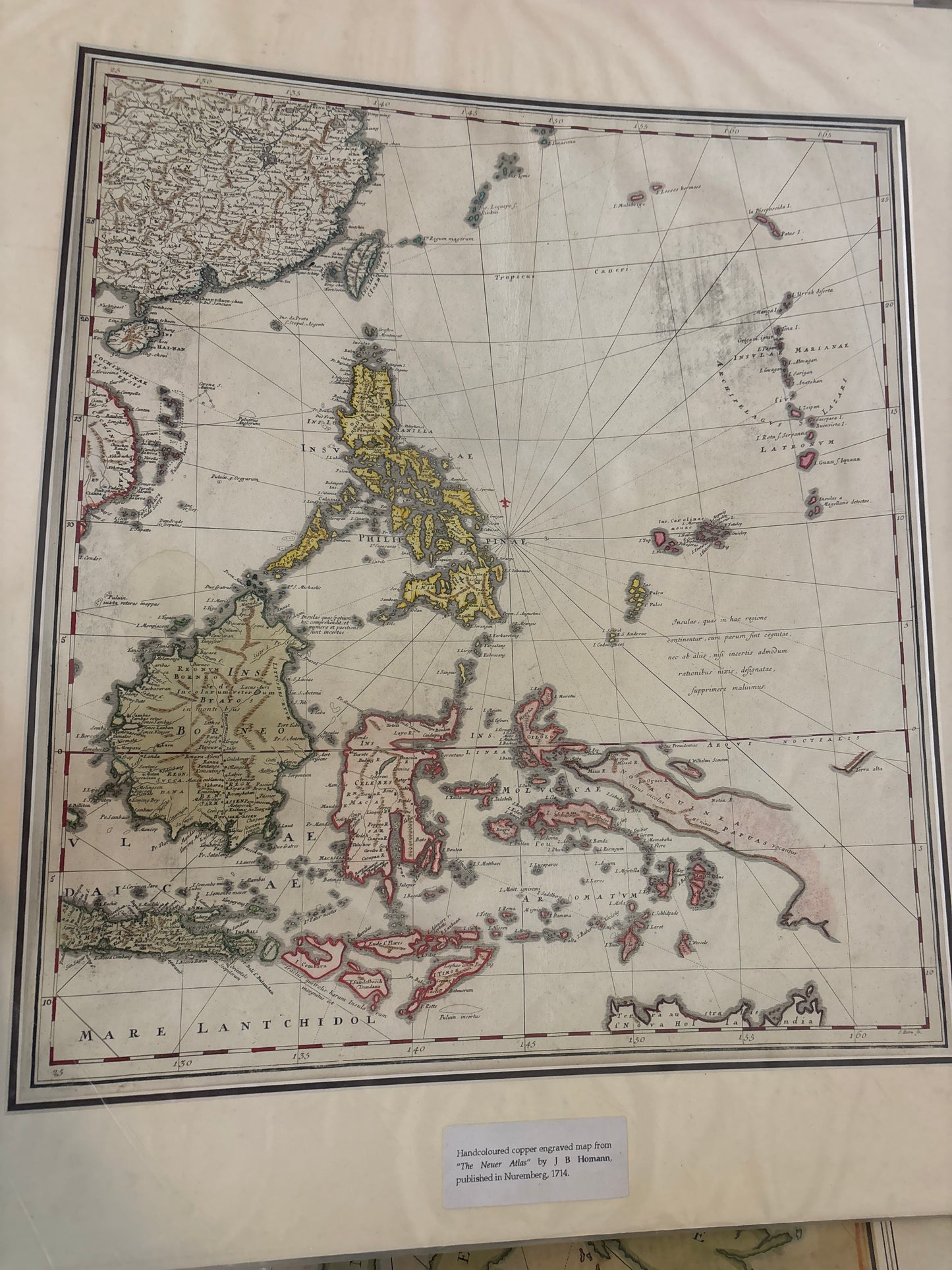
East Indies and Adjacent Islands - Homann c. 1712
East Indies and Adjacent Islands - Homann c. 1712
Title: Indiae Orientalis cum Adiacentibus Insulis (The East Indies and Adjacent Islands)
Cartographer: Johann Baptist Homann (1664–1724)
Published: Nuremberg, c. 1712–1714
Technique: Copperplate engraving with original hand-coloring
Description: A stunning and highly detailed 18th-century map of Southeast Asia, published by the celebrated Imperial Geographer Johann Baptist Homann. This map was a centerpiece of Homann’s Neuer Atlas and represents a pivotal era in German cartography, where Nuremberg began to challenge the Dutch dominance of the map trade.
The map covers a vast area from the Bay of Bengal to the Pacific Ocean, including the Philippines, Borneo, Sumatra, Java, the Celebes (Sulawesi), and the northern tip of Australia (labeled as Terra Borealis Incognita or New Holland).
Key Features:
-
The Philippines: Beautifully rendered with significant detail for the period, showing the various island groups under Spanish influence.
-
The Spice Islands: The Moluccas are clearly delineated, reflecting their immense economic importance to European powers like the VOC (Dutch East India Company).
-
Decorative Elements: The map features classic 18th-century rhumb lines (navigation lines) radiating from central points, emphasizing its origins as a nautical-style chart.
-
Artistry: The hand-coloring distinguishes the various colonial spheres of influence and geographic boundaries, making it an exceptional display piece.