Treasures of the Orient
Plan de Selangor (Plan of Selangor and the Coast of Malaya) - Bellin c. 1764
Plan de Selangor (Plan of Selangor and the Coast of Malaya) - Bellin c. 1764
Title: Plan de Salangor et de la Cote de Malaye (Plan of Selangor and the Coast of Malaya) Cartographer: Jacques-Nicolas Bellin (1703–1772)
Published: Paris, c. 1764
Technique: Copperplate engraving with hand-coloring
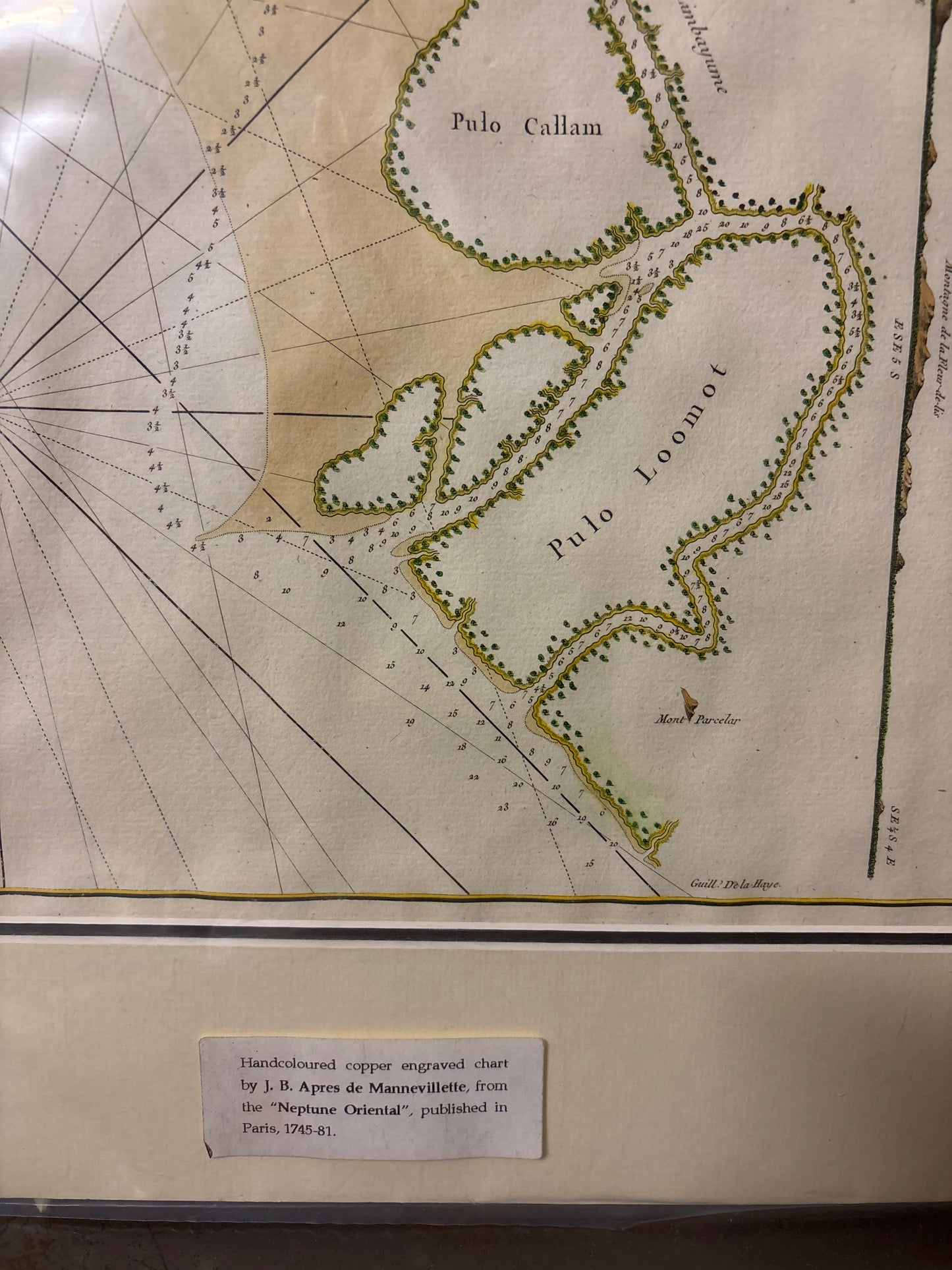
Description: An exceptional and rare 18th-century nautical chart detailing the coastline of the Malay Peninsula, specifically focusing on the region of Selangor. This map was produced by Jacques-Nicolas Bellin, the preeminent French hydrographer, for his monumental work, the Petit Atlas Maritime.
The chart is a masterpiece of Enlightenment-era hydrography, designed for navigators charting the treacherous waters of the Straits of Malacca. It extends from Pointe de Caran (Jeram) down to Mont Parcelar (Bukit Jugra), a famous landmark for sailors in the 18th century.
Key Features:
-
Coastal Detail: Includes precise soundings (depth measurements) and identifies Pulo Callam (Pulau Indah) and Pulo Loomot (Pulau Lumut).
-
Coastal Profiles: Along the right-hand margin, the map features three distinct "views" or coastal profiles. These were vital for 18th-century captains to recognize the shoreline from the deck of a ship.
-
Nautical Precision: The map is crisscrossed with rhumb lines radiating from a compass rose, featuring the distinctive French fleur-de-lis.
-
Historical Significance: One of the earliest focused scientific charts of the Selangor coast, predating the British colonial expansion in the region.