Treasures of the Orient
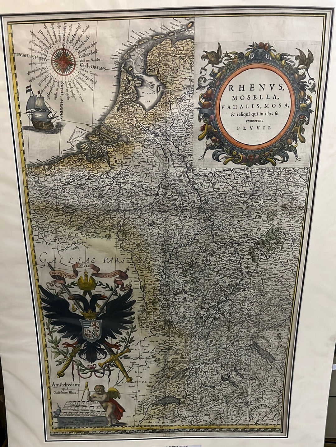
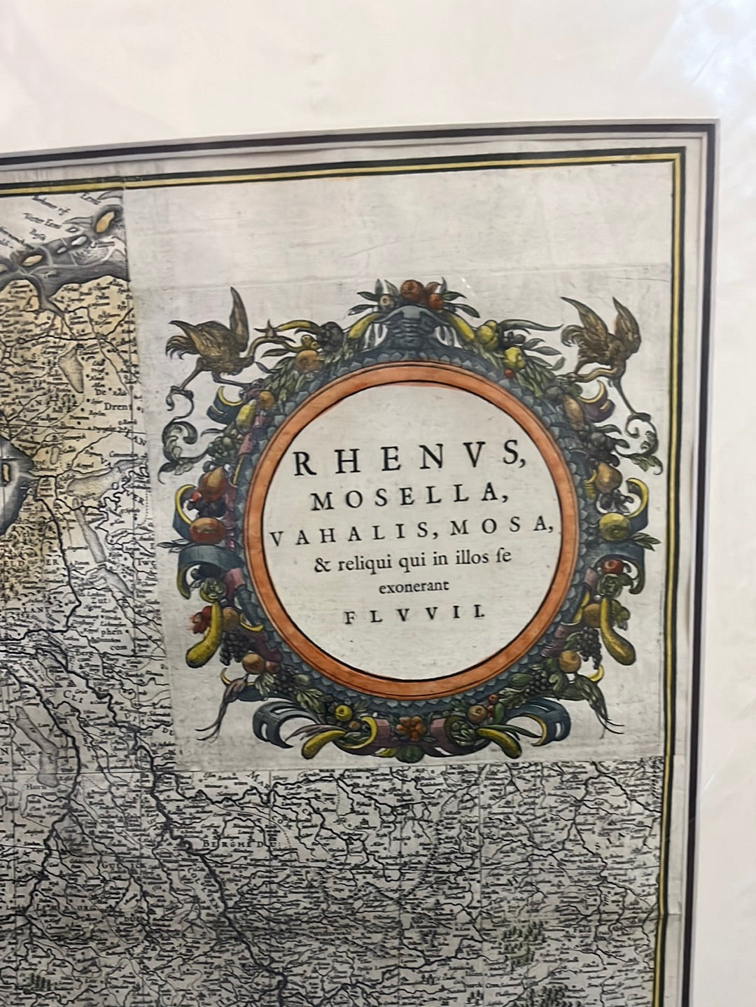
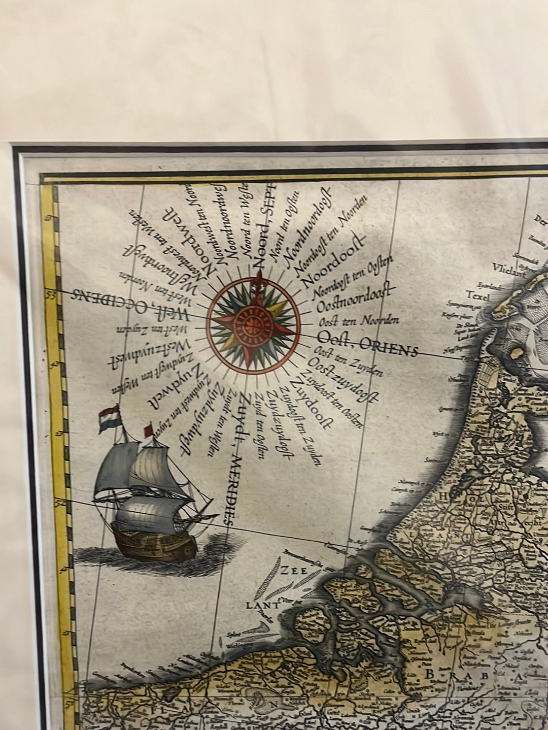
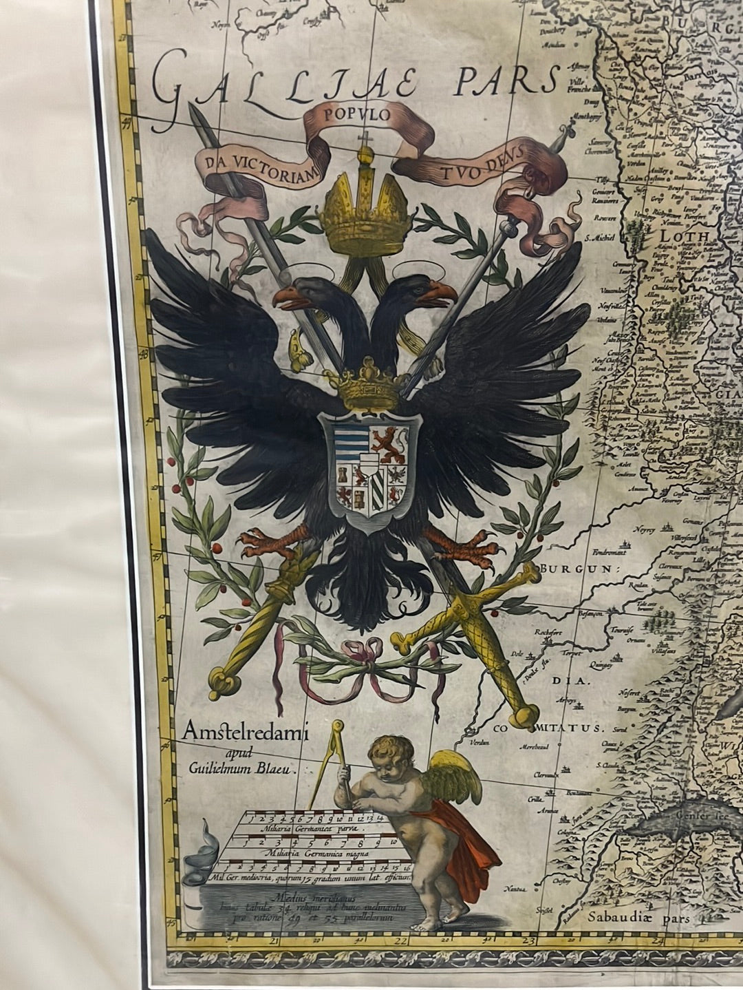
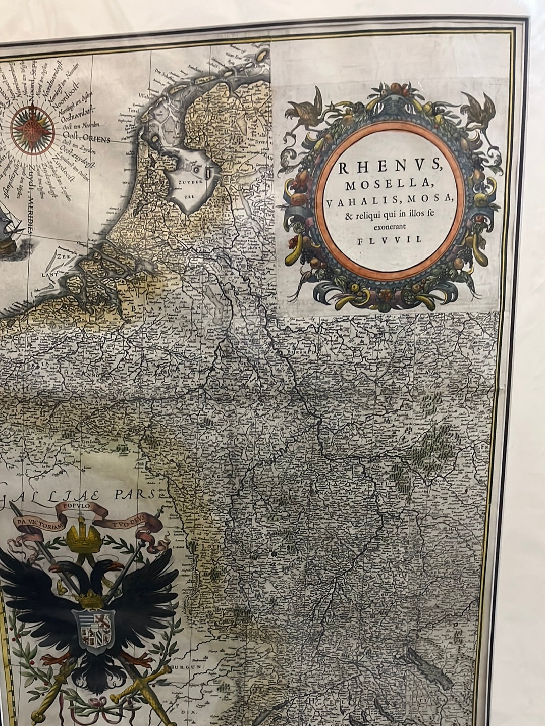
Rhenus, Mosella, Vahalis, Mosa & reliqui qui se exonerant fluvii - Bleau 1635
Rhenus, Mosella, Vahalis, Mosa & reliqui qui se exonerant fluvii - Bleau 1635
Rhenus, Mosella, Vahalis, Mosa & reliqui qui se exonerant fluvii
Drawn by: Willem Janszoon Blaeu (Guilielmus Blaeu)
Published in: Amsterdam
Year: 1634 (First Edition)
From: Atlas Novus (German edition)
Condition: Features a large title cartouche and impressive imperial heraldry.
A Rare Fragment of the Great Wall Map
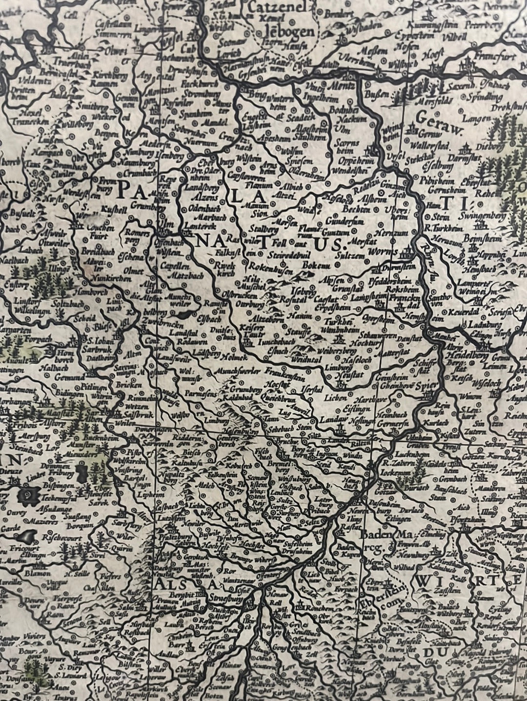
This 1634 engraving is a unique piece of cartographic history. Unlike standard atlas plates, this specific map was adapted from Willem Janszoon Blaeu’s massive wall map of Germany. It was repurposed specifically for the 1634 German edition of the Atlas Novus, featuring a custom title cartouche and a higher level of topographical detail than typical regional charts.
Hydrology and Imperial Heraldry
The map meticulously charts the vital river systems of Northern Europe, focusing on the Rhine (Rhenus), Moselle (Mosella), Waal (Vahalis), and Meuse (Mosa).
- The Imperial Eagle: The lower-left corner is dominated by a magnificent double-headed eagle, the heraldic symbol of the Holy Roman Empire, representing the diverse political territories through which these rivers flowed.
- Artistic Composition: The upper-right title cartouche features personifications of the major rivers, while the upper-left banner is typically adorned with the coats of arms of the ten regions the Rhine passes through.
- Rarity: Because this "re-purposed" wall map fragment was only included in specific early German editions, it is considered much rarer and more detailed than the standard folio Rhine maps published by the Blaeu firm in later years.