Treasures of the Orient
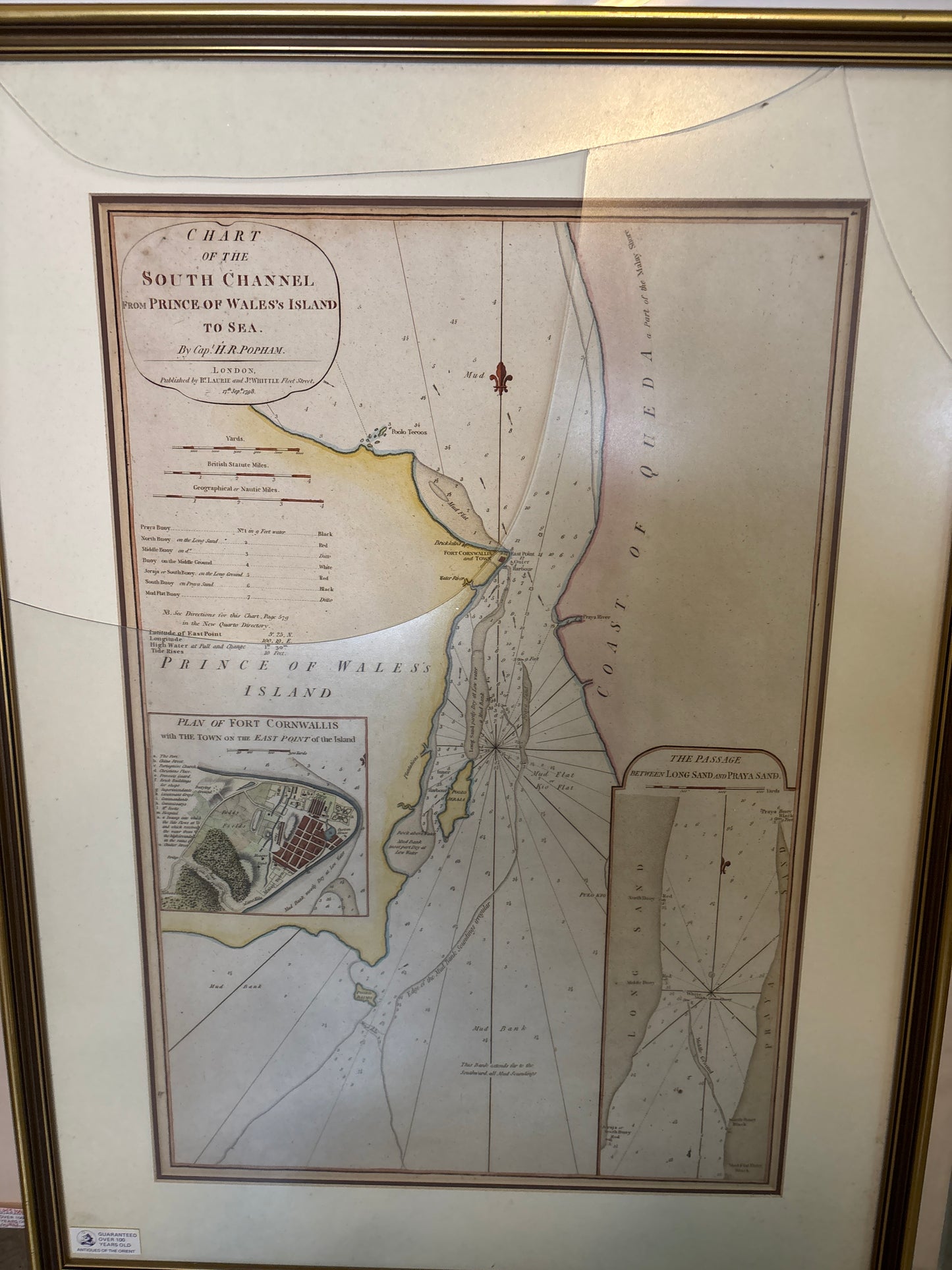
Chart of the South Channel from Prince of Wales's Island to Sea - Popham, 1798
Chart of the South Channel from Prince of Wales's Island to Sea - Popham, 1798
Title: Chart of the South Channel from Prince of Wales's Island to Sea
Cartographer: Captain Sir Home Riggs Popham (1762–1820)
Published: London, by Laurie & Whittle, 27th Sept 1798
Technique: Copperplate engraving with original hand-coloring
*New frame ordered
Description: A highly important hydrographic chart of Penang (then known as Prince of Wales's Island) during the early years of the British settlement. This chart was created by Captain Popham, a celebrated British naval officer, to provide safe passage through the treacherous South Channel.
The map is exceptionally detailed, featuring an inset "Plan of Fort Cornwallis" which shows the early layout of the town on the East Point of the island. It includes soundings, sandbank locations, and specific sailing marks used by the East India Company ships.
Key Features:
-
Early Penang History: Published just 12 years after Francis Light established the colony in 1786.
-
Fort Cornwallis Inset: A rare early architectural plan of the fort and the grid-style town planning of early George Town.
-
Maritime Provenance: Published by the renowned firm of Laurie & Whittle, who were the primary suppliers of maritime charts to the British Admiralty and the East India Company at the turn of the 19th century.