Treasures of the Orient
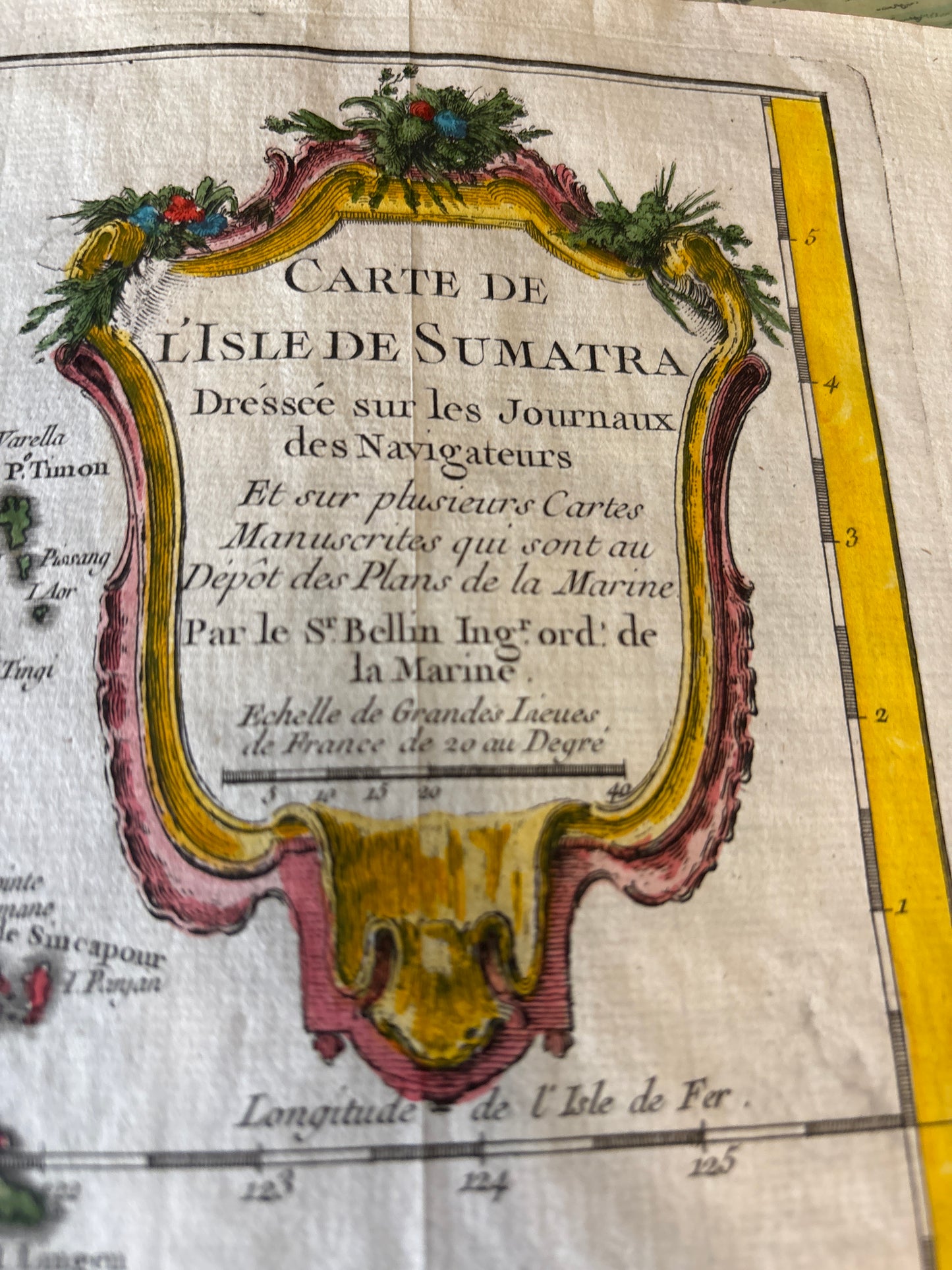
Carte de l'Isle de Sumatra (Map of the Island of Sumatra) - Bellin c.1750
Carte de l'Isle de Sumatra (Map of the Island of Sumatra) - Bellin c.1750
Title: Carte de l'Isle de Sumatra (Map of the Island of Sumatra)
Cartographer: Jacques-Nicolas Bellin (1703–1772)
Published: From Histoire Générale des Voyages, c. 1750
Technique: Copperplate engraving with fine hand-coloring
Description: An intricate and historically significant 18th-century map of Sumatra, the Malay Peninsula (Presqu'Isle de Malaca), and the surrounding islands. As the official hydrographer to the French Navy, Bellin utilized logs from various navigators to create this chart, which served as a primary reference for French maritime interests in the East Indies.
Key Features:
-
Geographical Scope: Meticulously details the rugged coastline of Sumatra, including the major settlements of Palimbang (Palembang), Padang, and Achem (Aceh). It also clearly depicts the Strait of Malacca, the most important maritime corridor in Southeast Asia.
-
Topographical Details: The interior is filled with artistic mountain ranges and river systems, though the note in the bottom-left corner ("L’interieur... ne sont pas connus") honestly admits that the island's heart remained largely unexplored by Europeans at the time.
-
Decorative Cartouche: Features a stunning Rococo-style title cartouche in the upper right, draped with floral garlands, and a separate "Nota" cartouche in the lower left explaining local linguistic terms like Tanjong (Point/Cape) and Pulo (Island).
-
Hand-Coloring: Each region is outlined in a contrasting hue (yellow for Sumatra, pink for the Malay Peninsula), characteristic of high-quality 18th-century French maps.