Treasures of the Orient
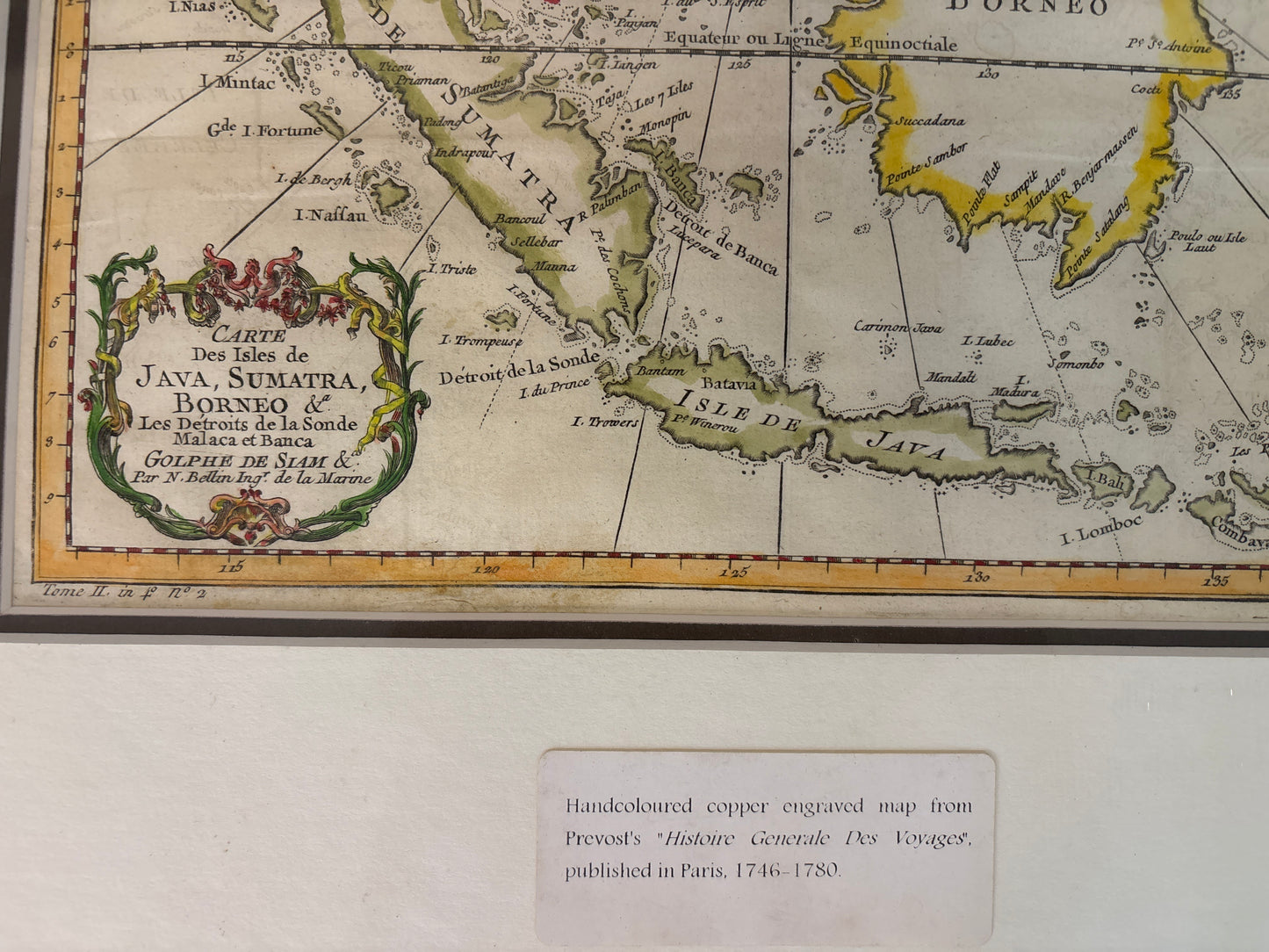
Java, Sumatra, Borneo & Straits of Sunda - Bellin c.1748
Java, Sumatra, Borneo & Straits of Sunda - Bellin c.1748
Title: Carte des Isles de Java, Sumatra, Borneo & les Detroits de la Sonde Malaca et Banca (Map of the Islands of Java, Sumatra, Borneo & the Straits of Sunda, Malacca, and Banca)
Cartographer: Jacques-Nicolas Bellin (1703–1772)
Published: Paris, c. 1748–1750
Technique: Copperplate engraving with hand-coloring
Description: An essential 18th-century maritime chart detailing the core of the East Indies. This map focuses on the strategic shipping lanes between the Indian Ocean and the South China Sea, including the critical Straits of Malacca and Sunda. Published during the height of the spice trade, it reflects the intense competition between the French, Dutch, and British for dominance in the region.
Key Features:
-
Maritime Precision: The map is crisscrossed with rhumb lines radiating from a central compass rose, designed for practical navigation and the plotting of courses between the major islands.
-
Regional Hubs: Clearly identifies the colonial strongholds of Batavia (Jakarta) on Java and Malaca (Melaka) on the Malay Peninsula.
-
The "Equateur ou Ligne Equinoctiale": The Equator is prominently marked across the center of Sumatra and Borneo, showcasing the scientific nature of Bellin's hydrographic work.
-
Kingdom of Siam: To the north, the coastline of the "Golfe de Siam" and "Cambodia" is rendered, providing a complete view of the maritime routes connecting Southeast Asian kingdoms to the archipelago.
-
Cartouche: A charmingly ornate Rococo cartouche in the lower-left corner frames the title, typical of the elegance of mid-18th-century French cartography.