Treasures of the Orient
A Map of the Island of Sumatra with the East Straits - Marsden 1811
A Map of the Island of Sumatra with the East Straits - Marsden 1811
A Map of the Island of Sumatra with the East Straits
Drawn by: William Marsden (Engraved by J. Walker)
Published in: London by Longman, Hurst, Rees, Orme, and Brown
Year: 1811 (Third Edition)
From: The History of Sumatra
Condition: Hand-coloured copperplate engraving; professionally framed.
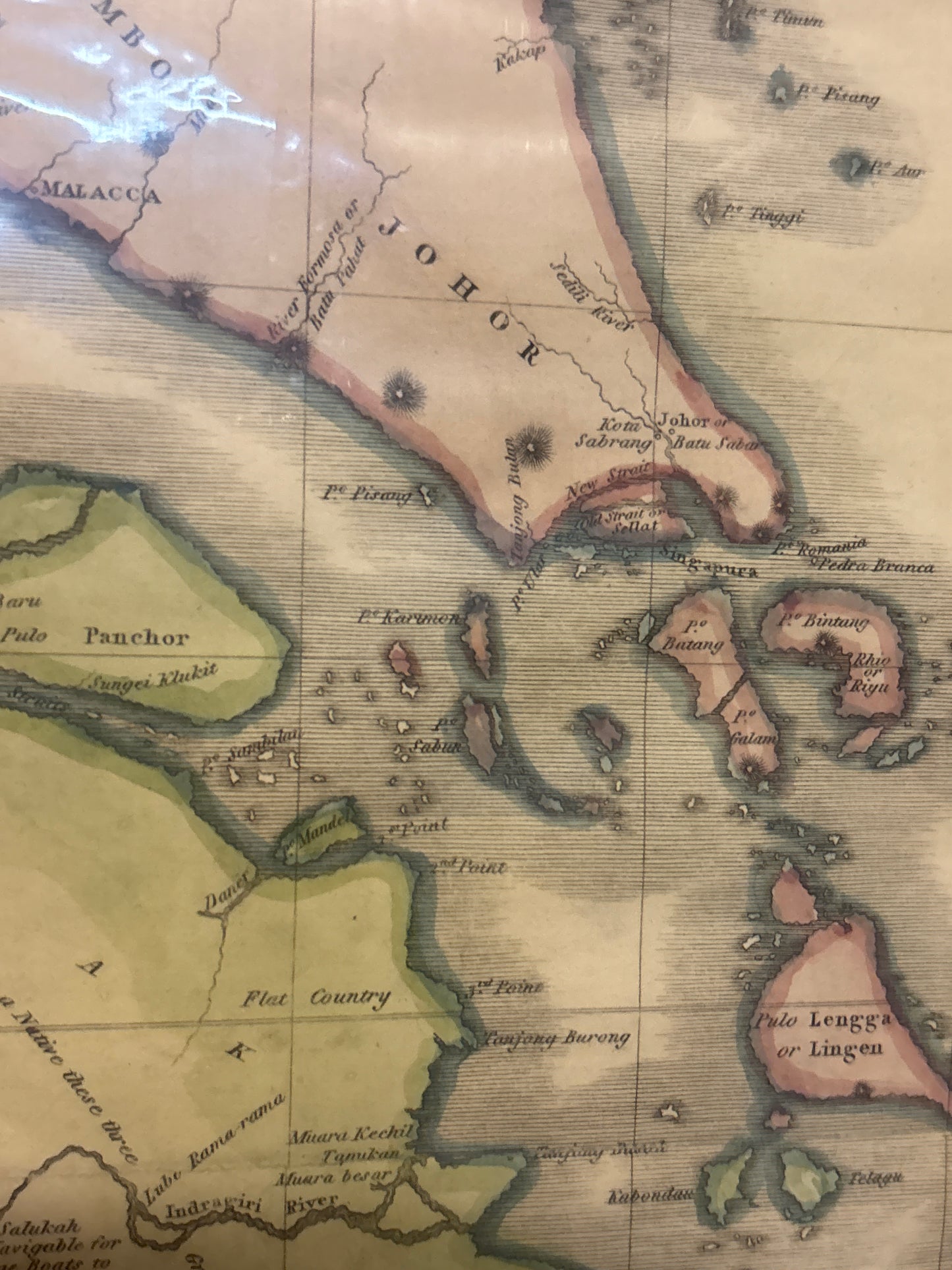
A Pioneering Scientific Record of the Malay Archipelago
This spectacular 1811 map is the definitive visual record from the third and most complete edition of William Marsden’s seminal work, The History of Sumatra. Marsden, a prominent English orientalist and official of the East India Company, produced what was widely considered the first truly comprehensive and scientific account of the island, moving past the speculative myths of earlier centuries.
The "East Straits" & Regional Significance
For the collector of Singapore and Malayan history, this map is of particular importance. The title specifically highlights the inclusion of the "East Straits"—referring to the strategically vital waterways of the Straits of Malacca and Singapore.
- Geographic Accuracy: Unlike earlier charts, Marsden utilized recent hydrographic surveys and astronomical readings to chart the coastlines of Sumatra and the southern tip of the Malay Peninsula with unprecedented precision.
- Pre-Colonial Context: Published just eight years before the founding of modern Singapore by Raffles, it captures the region during a pivotal transition where British and Dutch interests were fiercely competing for control over these maritime choke points.
- Artistic Quality: The map features the clean, authoritative engraving style of the London school, accented by vibrant hand-colouring that identifies political territories and treacherous shoals.