Treasures of the Orient
Sumatra - Norie c.1833
Sumatra - Norie c.1833
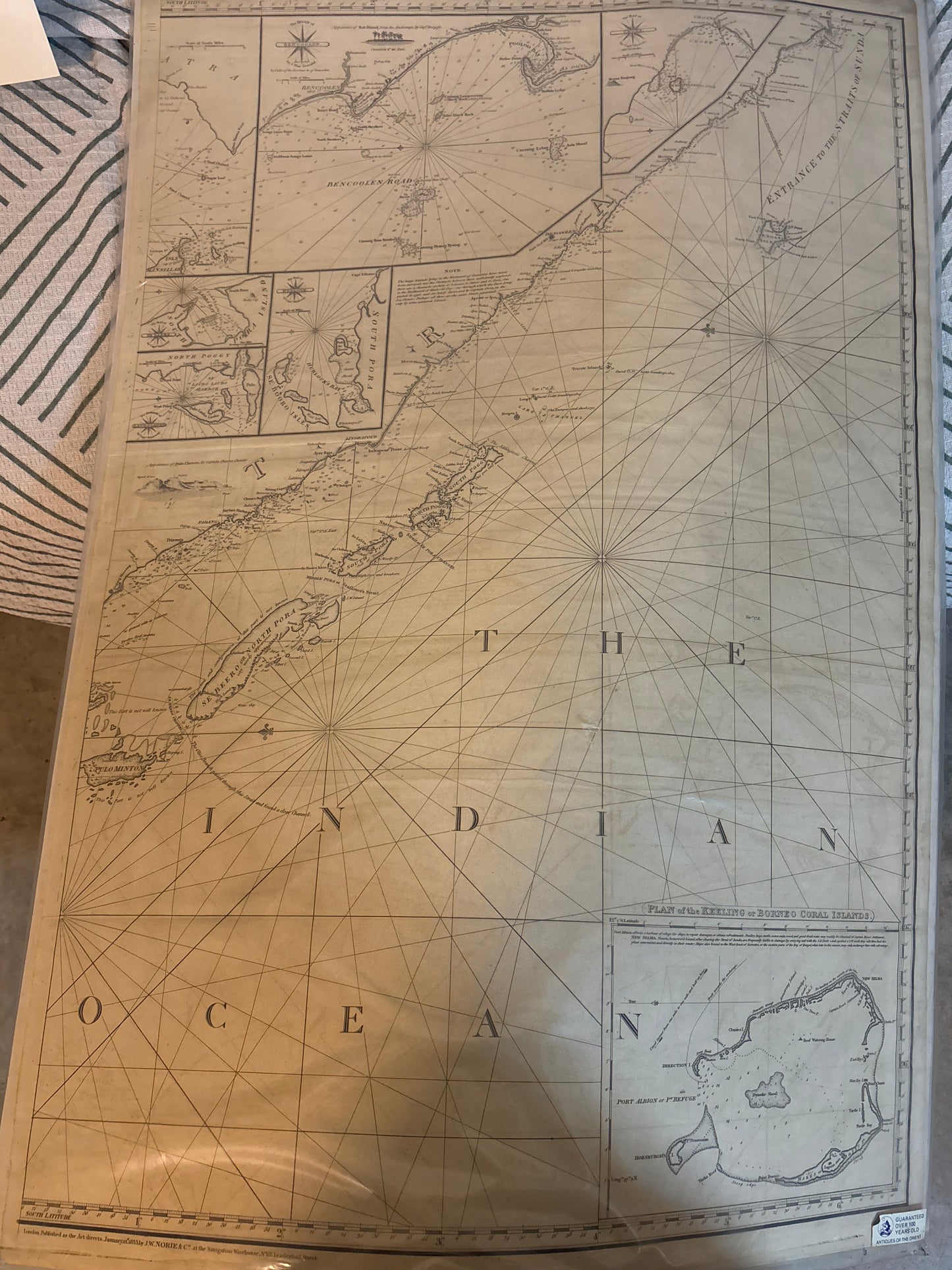
Title: A Chart of the West Coast of Sumatra and Isles Adjacent
Cartographer: John William Norie
Origin: London, United Kingdom
Date: Published January 1833
Technique: Large-format copperplate engraving
Navigating the Spice and Pepper Coast
In 1833, the west coast of Sumatra was a high-value but dangerous frontier for European trade. This chart tells the story of the perilous "Pepper Coast," where American and European ships vied for control of the region's lucrative spice trade. Unlike the decorative atlases of the Renaissance, this Norie chart was a life-saving instrument.
Every tiny dot and "X" on this paper represents a hidden reef, a sandbar, or a depth sounding meticulously recorded by surveying vessels. It shows the navigation from Acheen Head (Banda Aceh) at the northern tip down to Flat Point in the south. For a 19th-century sailor, this map was the difference between a successful voyage to London or New York and a shipwreck on a Sumatran coral head.
Chronicles of the Chart
-
The Norie Legacy: J.W. Norie was the most celebrated hydrographer of the 19th century. His charts were so trusted that "Norie’s Epitome" became the standard textbook for British naval officers. This chart represents the pinnacle of pre-Victorian maritime science.
-
Coastal Profiles: Along the top and sides, you can see "views" or "appearances" of the land. These horizontal sketches allowed mariners to identify specific mountains or headlands from the sea to confirm their position before GPS existed.
-
The Straits of Malacca: The chart includes a detailed look at the entrance to the Straits of Malacca, the world's most vital maritime chokepoint then and now. It plots the small islands and passages that ships had to navigate to reach the burgeoning port of Singapore.
-
The "Two-Sheet" Format: Being a large, double-sided work, it allowed for an immense level of detail that a standard atlas could not accommodate. It essentially provided a high-resolution "zoom" of the entire coastline, from the northern sultanates down to the southern Dutch settlements.