Treasures of the Orient
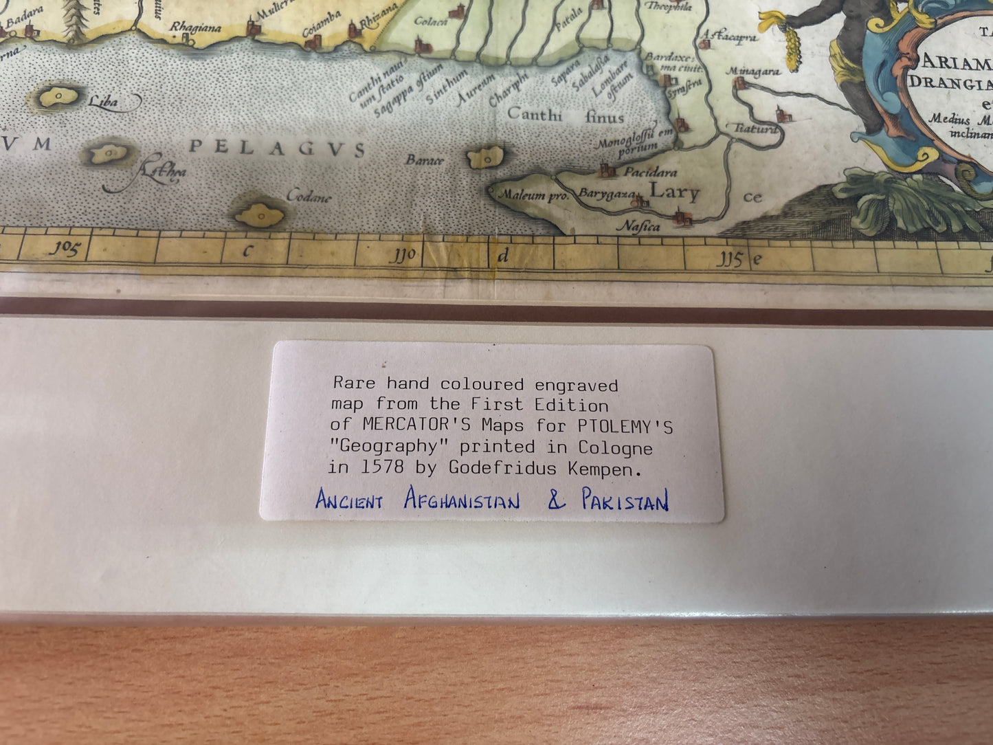
Tab. IX. Asiae - Mercator 1578
Tab. IX. Asiae - Mercator 1578
Title: Asiae IX Tab: Ariam, Paropanisum, Drangianam, Arachosiam et Gedrosiam Cartographer: Gerard Mercator (after Claudius Ptolemy)
Published: 1578 (First Edition)
Technique: Early copperplate engraving, exquisite hand colouring
Description: A striking and detailed Ptolemaic map of Central Asia, focusing on the regions of modern-day Pakistan, Afghanistan, and Eastern Iran. This map was produced by the legendary cartographer Gerard Mercator as part of his efforts to revise and perfect the works of the 2nd-century geographer Claudius Ptolemy.
The engraving captures the ancient world as understood by the Greeks, featuring the Indus River valley (Indo), the Himalayan mountain ranges, and the historical provinces of Arachosia and Gedrosia. The map is famously adorned with a decorative Baroque-style title cartouche in the lower right, depicting regional inhabitants and merchants with bolts of cloth and cowrie shell currency. This piece represents a bridge between Renaissance precision and ancient geographical lore, making it a cornerstone for any collector of Asian cartography.
-
Authenticity: Original copperplate engraving with later hand-coloring.
-
Key Features: Detailed mountain ranges, river systems, and classical Latin nomenclature.
-
Dimensions: Approximately 40cm x 34cm.