Treasures of the Orient
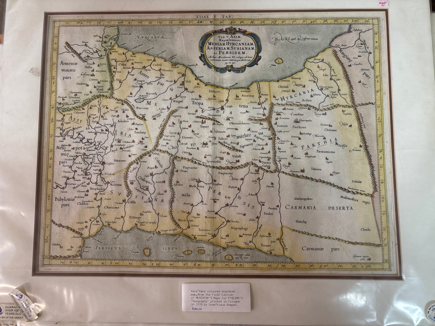
Tab. V Asiae, Repraesentans Mediam, Hyrcaniam, Assyriam, Susianam, ac Persidem - Mercator 1578
Tab. V Asiae, Repraesentans Mediam, Hyrcaniam, Assyriam, Susianam, ac Persidem - Mercator 1578
Title: Asiae V Tab: Representans Mediam, Hyrcaniam, Assyriam, Susianam, ac Persidem
Cartographer: Gerardus Mercator (after Claudius Ptolemy)
Origin: Cologne / Amsterdam
Date: 1578 (First Edition)
Technique: Copperplate engraving with professional hand-colouring
A Masterpiece from the Father of Modern Cartography
This map is a spectacular example of the work of Gerardus Mercator, the man who revolutionized navigation with the "Mercator Projection." However, this specific map comes from his "Ptolemy Project," where he spent years painstakingly re-engraving the maps of the 2nd-century Alexandrian geographer Claudius Ptolemy to show the world as it was known in antiquity.
Historical Highlights & Fun Facts
-
The "First Edition" Prestige: As noted on the gallery tag, this is from the very first edition printed in 1578. Mercator’s engravings for this series are considered far superior to those of his predecessors, featuring a clarity and elegance that set the standard for the next century.
-
Ancient Geography: The map depicts the heart of the ancient Persian Empire. It covers a vast territory including modern-day Iran, Iraq, and parts of the Caucasus. You can find famous ancient regions labeled such as Assyria, Babylonia, Media, and Parthia.
-
The Caspian Sea: Notice the shape of the Mare Hyrcanum (Caspian Sea). In the 1500s, Europeans still relied on Ptolemy’s ancient measurements, which often depicted the Caspian as being wider than it was long—a classic cartographic trait of this era.
-
Artistic Flourishes: The map features a beautiful Baroque-style strapwork cartouche at the top center. The sea is textured with "stipple" engraving, a labor-intensive technique used to give the water a shimmering, rhythmic appearance.
-
Ptolemy’s Legacy: This map represents the 16th-century "Renaissance" of classical knowledge. Mercator wasn't just making a map; he was creating a scholarly bridge between the ancient world and the burgeoning age of exploration.