Treasures of the Orient
Tabula Asia IX - Münster 1540
Tabula Asia IX - Münster 1540
Tabula Asiae IX
Drawn/Published by: Sebastian Münster
Location: Basle (Basel)
Year: 1540 (First issued)
From: Geographia Universalis
Condition: Original woodcut engraving; black and white as issued, professionally matted
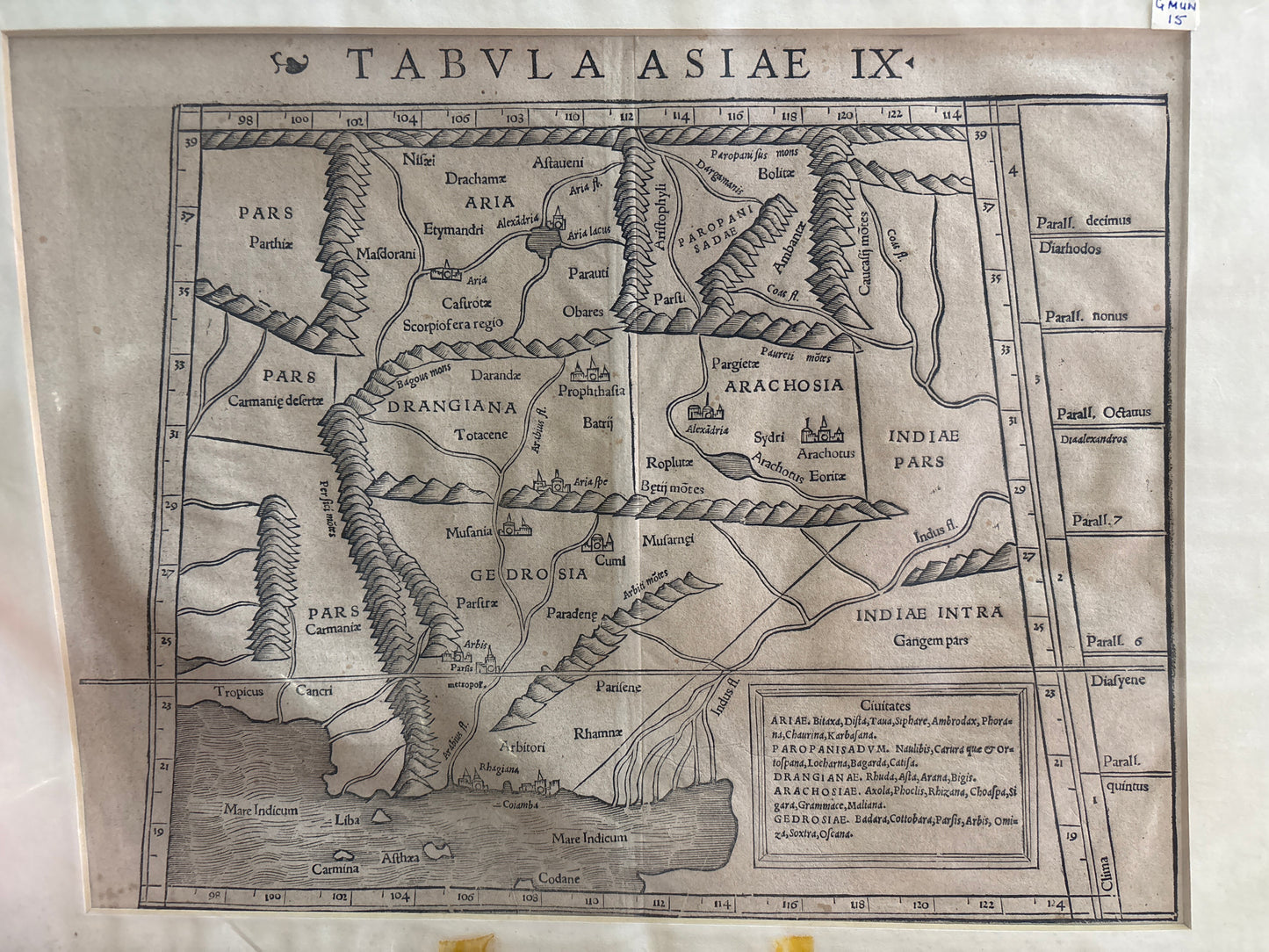
A Woodcut Landmark of Early Modern Cartography
This exceptional map, titled Tabula Asiae IX, is a historical treasure from Sebastian Münster's influential 1540 edition of Ptolemy's Geographia. Münster, a renowned German geographer and mathematician, redesigned these plates based on classical antiquity, making his work the standard geographical reference for the mid-16th century.
Geographic and Historical Scope
The map illustrates the Ptolemaic concept of the regions west of the Indus River, covering areas that comprise present-day Pakistan, Afghanistan, and eastern Iran.
- Ancient Provinces: The regions of Aria, Drangiana, and Arachosia refer to modern Afghanistan, while Gedrosia roughly corresponds to Balochistan.
- Pictorial Features: Despite its stylized pictorial representation of mountain ranges, the course of the Indus River is remarkably accurate.
- Toponymy Table: A table in the lower right lists the principal cities (Civitates) of these ancient provinces, such as Alexandria in Aria and various settlements in Arachosia.
Artistic Merit
Characterized by bold woodcut lines, the map features a distinctive trapezoidal border with climate zone indicators (Parall.) along the right margin. These "modern" maps by Münster were the first to show contemporary geographical knowledge for their respective areas to a broad public audience.