Treasures of the Orient
Tabula noua Indiæ orientalis & meridionalis - Munster c.1540
Tabula noua Indiæ orientalis & meridionalis - Munster c.1540
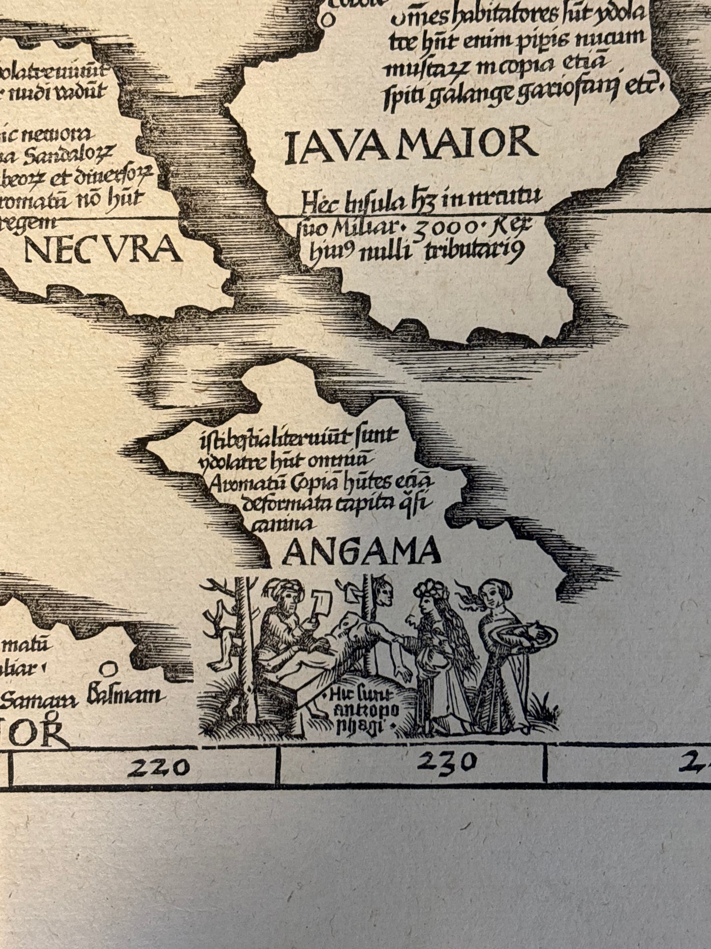
"A rare piece of 'Monstrous Cartography.' This 16th-century masterpiece by Sebastian Münster features the legendary dog-headed cannibals of the Andaman Islands—a chilling and iconic representation of the mysteries of the Renaissance-era East Indies."
Title: Tabula noua Indiæ orientalis & meridionalis
Cartographer: Sebastian Münster
Published: Basel, c. 1540–1552
Technique: Woodcut
Description: This influential map is one of the earliest "modern" maps of Southeast Asia and the Indian Ocean to appear in a printed atlas. Published in Münster’s edition of Ptolemy’s Geographia, it breaks away from strictly ancient views to incorporate contemporary Portuguese and Spanish discoveries.
The map provides a fascinating, albeit distorted, view of the region. It prominently features "Iava Maior" (Java) and "Iava Minor" (likely representing Sumatra or Sumbawa), along with "Seylam" (Sri Lanka) and the "Aurea Chersonesus" (Malay Peninsula). One of its most distinctive features is the ethnographic woodcut in the lower right corner depicting the inhabitants of "Angama" (the Andaman Islands), whom Marco Polo famously—and incorrectly—described as dog-headed cannibals. The map is filled with Latin annotations describing the exotic riches of the East, including spices, precious stones, and strange beasts.
-
Authenticity: Original 16th-century woodcut.
-
Historical Significance: One of the first maps to identify various islands of the East Indies by their modern names rather than purely classical ones.
-
Decorative Elements: Features a prominent ethnographic illustration and bold, archaic typography typical of the Basel school of printing.