Treasures of the Orient
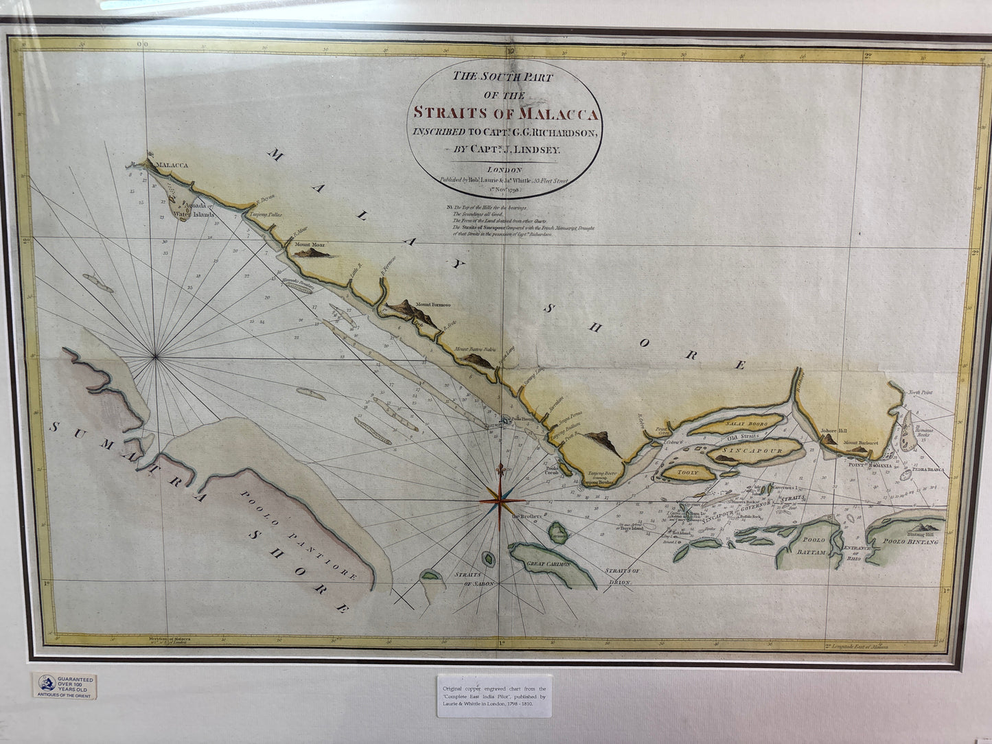
Straits of Malacca - Lindsey 1798
Straits of Malacca - Lindsey 1798
Drawn by: Captain J. Lindsey (Inscribed to Captain G. G. Richardson)
Published in: London
Year: 1798
From: Originally published by Aaron Arrowsmith (Hydrographer to the Prince of Wales)
Tastefully hand-coloured and presented in a gold, ornate frame
Price: TBA (please enquire)
A Rare Nautical Masterpiece of the East Indies
This exceptional 1798 maritime chart is a vital record of British naval exploration during the height of the East India Company’s influence. Surveyed by Captain J. Lindsey and dedicated to his contemporary, Captain G. G. Richardson, the map provides a high-precision view of the strategically critical Straits of Malacca—the primary gateway for the tea and spice trade between Europe, India, and China.
Coastal Landmarks & Navigational Highlights
What makes this specific chart highly valuable to collectors are the meticulously engraved coastal landmarks used by 18th-century mariners to navigate these treacherous waters:
- The "Governor’s Straits": Lindsey famously identifies a preferred passage past Singapore island, labeling it "Sincapour or Governor's Straits"—the precursor to the modern Singapore Strait.
- Singapore and its Neighbors: The island of "Sincapour" is depicted alongside "Salat Booro" and "Tooly," which historians believe correspond to modern-day Pulau Ubin and Sentosa.
- Prominent Coastal Peaks: Key navigational bearings include Mount Moar, Mount Formoso (near modern Batu Pahat), Mount Battou Batou, and Jahore Hill.
Strategic Points: The map extends from the primary trading port of Malacca south to Point Romania and Poolo Bintang, capturing the entire southern tip of the Malay Peninsula.
Historical Provenance
As a working tool for Georgian-era mariners, this chart was designed for survival and profit. The formal inscription to Captain Richardson adds a unique layer of professional history, marking a period when the British were identifying the exact locations that would later become the world's busiest shipping lanes.