Treasures of the Orient
Ottoman Empire - Vaugondy c.1751
Ottoman Empire - Vaugondy c.1751
Vaugondy’s Map of the Ottoman Empire (c. 1751–1753)
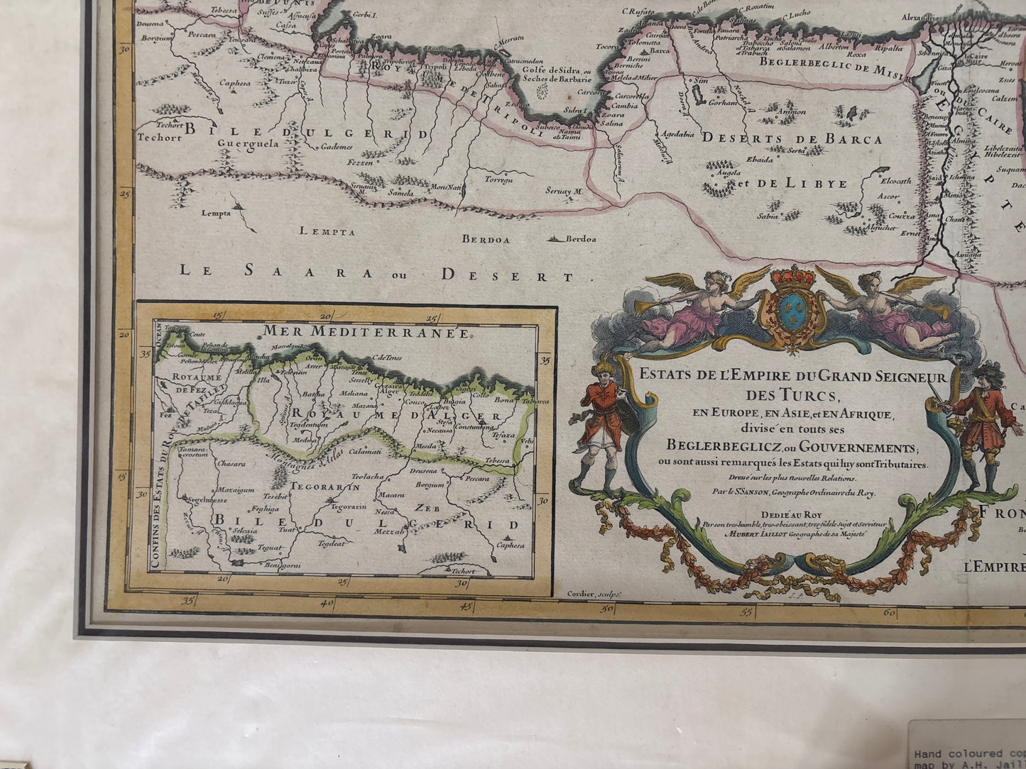
Title: Estats de l'Empire du Grand Seigneur des Turcs, en Europe, en Asie, et en Afrique, divisé en tous ses Beglerbeglicz ou Gouvernements.
Cartographer: Gilles Robert de Vaugondy
Origin: Paris, France
Date: c. 1751–1753
Technique: Copperplate engraving with original hand-colouring
The Narrative: Mapping the Height of the Ottoman Realm
This map tells the story of the sprawling Ottoman Empire at its mid-18th-century zenith, as viewed through the lens of the French Enlightenment. Gilles Robert de Vaugondy, who served as the Géographe Ordinaire du Roi to Louis XV, was known for his efforts to combine artistic elegance with modern geographic accuracy. This piece spans three continents, illustrating the vast territories under the Sultan's rule—from the Balkans and Hungary in Europe to Arabia and Persia in Asia, and across the North African coast to Egypt and Barbary.
It serves as a comprehensive political snapshot of the era, meticulously dividing the empire into its various administrative districts, known as Beglerbeglicz or Eyalets. For the 18th-century observer, this map was a crucial tool for understanding the shifting power dynamics between the Bourbon monarchy and the "Grand Seigneur" in Constantinople.
Chronicles of the Map
-
The Royal Cartographer's Seal: The bottom-center features a magnificent Baroque title cartouche. It is flanked by two figures—likely representing a European diplomat and an Ottoman official—resting on ornate foliage, symbolizing the diplomatic and commercial ties between France and the East.
-
The Mediterranean Perspective: The map provides an exceptionally detailed view of the Mediterranean Sea (labeled Mer Méditerranée), emphasizing the strategic importance of the maritime trade routes that connected the Levant to the Atlantic.
-
Inset Detail: A large inset map in the lower-left corner provides a more focused view of the Western Mediterranean and the North African interior (Le Saara ou Desert), offering additional clarity on the borders of the African regencies.
-
Topographical and Nautical Detail: Beyond political boundaries, Vaugondy includes detailed renderings of mountain ranges, major river systems like the Nile and the Danube, and coastal soundings, reflecting the increased scientific rigor of 18th-century French geography.