Treasures of the Orient
Ottoman Empire and Arabia - Bowen c.1744
Ottoman Empire and Arabia - Bowen c.1744
Bowen’s Map of the Ottoman Empire and Arabia (c. 1744–1747)
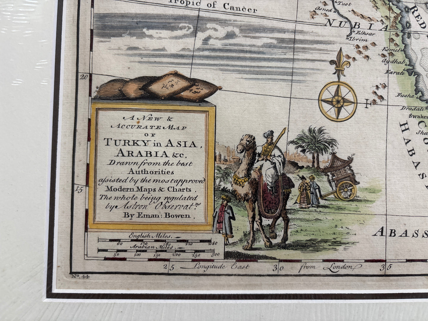
Title: A New & Accurate Map of Turky in Asia, Arabia &c. Drawn from the best Authorities...
Cartographer: Emanuel Bowen
Origin: London, United Kingdom
Date: c. 1744–1747
Technique: Copperplate engraving with original hand-colouring
The Narrative: The Crossroads of the Enlightenment World
This map tells the story of the 18th-century European attempt to chart the vast and complex territories of the Ottoman and Persian Empires. At a time when trade with the East was the lifeblood of European economies, Emanuel Bowen produced this "accurate" map to provide merchants and scholars with a reliable guide to the Levant, the Arabian Peninsula, and Mesopotamia. It captures a world of ancient names and burgeoning colonial interests, stretching from the Mediterranean Sea to the Persian Gulf.
The map serves as a vital record of the geopolitical landscape during the mid-1700s. It meticulously plots the caravan routes, desert regions like Arabia Deserta and Arabia Felix, and the strategic coastal ports that linked the Silk Road to the maritime empires of the West. It is a document of discovery, illustrating the "Empty Quarter" and the holy cities of Mecca and Medina through the eyes of the Enlightenment’s premier cartographer.
Chronicles of the Map
-
The Royal Cartographer: Emanuel Bowen was one of the most prolific and respected English mapmakers of his era, known for the high level of detail and descriptive text he included within his maps.
-
Detailed Cartouche: The lower-left corner features a charming pictorial cartouche depicting an exotic desert scene with a camel, a merchant, and a palm tree—a classic 18th-century shorthand for the wealth and mystery of the East.
-
Regional Divisions: The map is expertly divided into major historical and political territories, including Anatolia (Natolia), Syria, Diaberk, and the various tribal regions of the Arabian Peninsula.
-
Geographical Accuracy: Bowen explicitly states the map was "Drawn from the best Authorities" and "regulated by Astronl. Observat.," highlighting the 18th-century shift toward scientific and celestial navigation data in cartography.