Treasures of the Orient
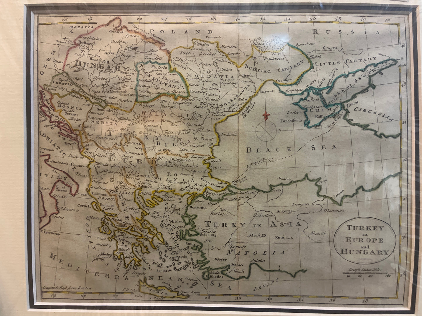
Turkey in Europe and Hungary c.1740
Turkey in Europe and Hungary c.1740
Title: Turkey in Europe and Hungary
Origin: London, United Kingdom
Date: c. 1740–1760
Technique: Copperplate engraving with hand-colouring
A Snapshot of the Ottoman Frontier
This map captures the geopolitical tension of the mid-18th century. It depicts the vast territories held by the Ottoman Empire in Europe, bordering the Kingdom of Hungary and the Russian Empire. It is a detailed administrative look at a region that was constantly being redrawn by the wars between the Ottomans, the Habsburgs, and Peter the Great’s Russia.
Historical Highlights & Fun Facts
-
The "Little Tartary" Connection: Look at the top right near the Black Sea. You’ll see a region labeled "Little Tartary" and the "Sea of Asoph." This was the homeland of the Crimean Tatars. In the 1740s, this was a fierce frontier zone where the Russian Empire was pushing south to gain its first warm-water port.
-
A "London" Perspective: The map is engraved in the classic English style of the era, characterized by clear, bold lettering and a simple, elegant title oval. Note the longitude at the bottom is measured "East from London" (the prime meridian hadn't been standardized to Greenwich yet).
-
The "Iron Gates" of the Danube: The map meticulously traces the Danube River as it snakes through Hungary and the Balkans. During this era, the Danube was the "superhighway" for both trade and invading armies.
-
Classical Place Names: You will find a fascinating mix of then-contemporary Ottoman names and classical Greek/Roman references, such as Macedonia, Thessaly, and Natolia (Anatolia).
-
The Red Fleur-de-lis: The simple but striking red compass rose (North point) is a common decorative feature in English maps of this period, helping travelers and scholars orient themselves on the "Grand Tour" or while following military dispatches from the East.