Treasures of the Orient
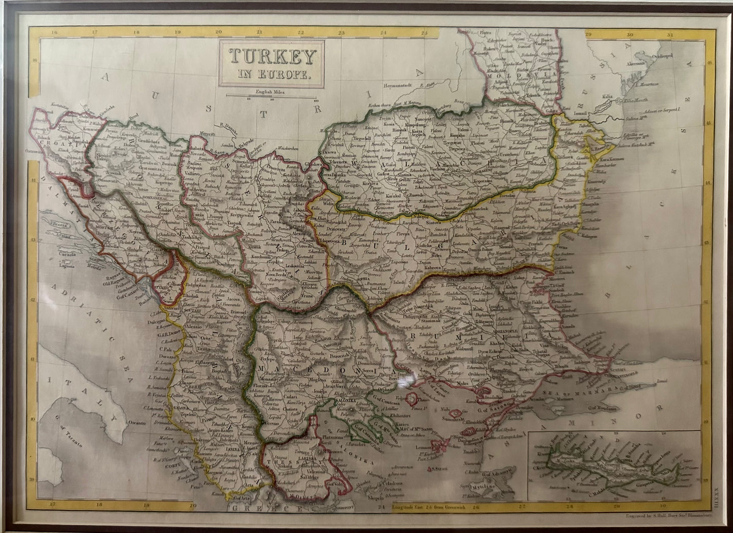
Turkey in Europe - Sidney Hall c.1828
Turkey in Europe - Sidney Hall c.1828
Title: Turkey in Europe
Cartographer: Sidney Hall
Published: London, c. 1828–1830
Technique: Steelplate engraving with original hand-coloring
Description: This finely engraved map by Sidney Hall illustrates the extensive European territories of the Ottoman Empire during the early 19th century. It covers the Balkan Peninsula, including modern-day Greece, Bulgaria, Romania (Wallachia and Moldavia), Serbia, and Bosnia. The map is a testament to the period’s precise British cartography, featuring clear topographical details such as mountain ranges, river systems, and major cities.
A notable feature is the inset map in the lower-right corner, which provides an enlarged view of Candia (Crete). The original hand-coloring serves to distinguish the various provinces and administrative divisions of the empire, while the sharp steelplate engraving allows for high density in the labeling of towns and geographic landmarks.
-
Authenticity: Original early 19th-century steelplate engraving.
-
Historical Significance: Captures the Ottoman Empire before the significant territorial shifts and independence movements that reshaped the Balkans later in the century.
-
Artist Pedigree: Sidney Hall was one of the most prominent engravers in London, known for his work on numerous prestigious atlases during the 1820s and 1830s.