Treasures of the Orient
Werelt Caert - Stoopendaal c.1680
Werelt Caert - Stoopendaal c.1680
Title: Werelt Caert (World Map)
Cartographer: Daniel Stoopendaal
Publisher: Keur/Blooteling, Amsterdam
Circa: 1680–1730
Technique: Copperplate Engraving with Hand-Coloring
This spectacular double-hemisphere world map is a masterpiece of Dutch Baroque engraving. Designed by Daniel Stoopendaal, it was created to be bound into the prestigious Statenbijbel—the authorized Dutch translation of the Bible. Because these maps were kept within the protected pages of heavy family bibles rather than exposed to light and soot on a wall, they are famous among collectors for their remarkable state of preservation and deep, rich engravings.
Cartographic Curiosities & "Famous Mistakes"
-
California as an Island: One of the most beloved "errors" in cartography is prominently featured here. For over a century, European mapmakers ignored earlier reports of California being a peninsula and depicted it as a massive island. It remains one of the most sought-after features for collectors of North Americana.
-
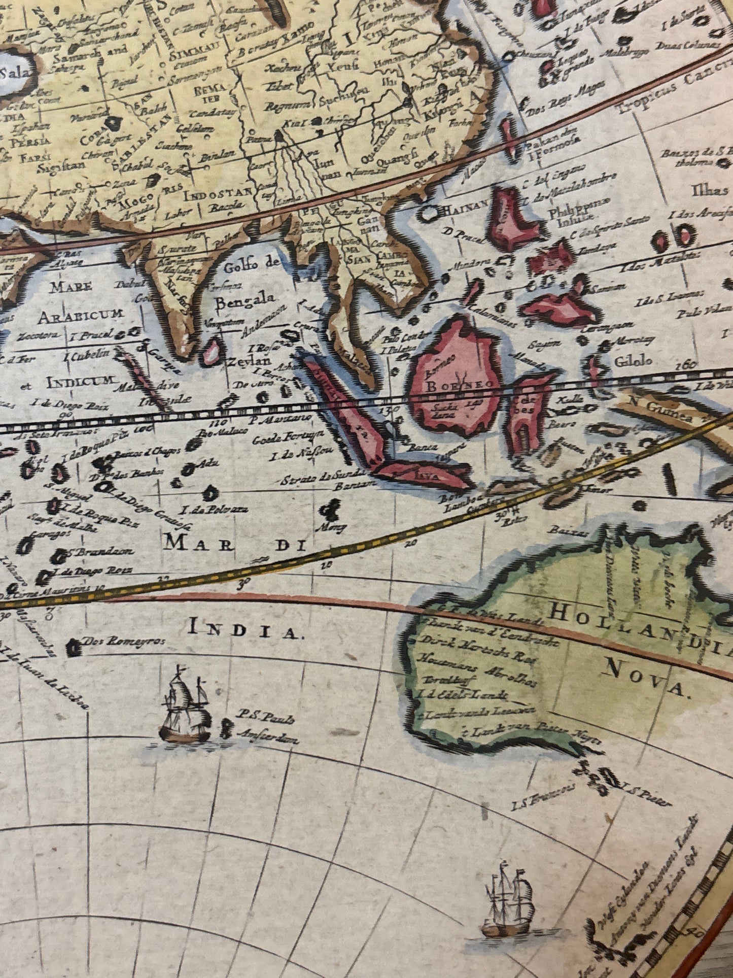
The Missing Australia: Australia is shown as "Hollandia Nova," but only the western and northern coastlines are present—reflecting the discoveries of Dutch explorers like Abel Tasman. The east coast is entirely absent, as it would not be charted by Captain Cook for another several decades.
-
The Northwest Passage: Above the "Island" of California lies the mythical Strait of Anian, the fabled shortcut to the riches of the Orient that fueled centuries of dangerous Arctic exploration.
Artistic & Allegorical Symbolism
The map is framed by four vivid corner illustrations personifying the continents as they were perceived in the 17th century:
-
Europe (Top Left): Crowned as a queen, surrounded by symbols of the arts, music, and scientific instruments, representing the "center of learning."
-
Asia (Top Right): Seated amongst exotic treasures, accompanied by a camel and a smoking censer, symbolizing the lucrative spice and incense trade.
-
Africa (Bottom Left): Depicted with an elephant and a crocodile, reflecting the European fascination with the continent’s "wild" interior.
-
America (Bottom Right): Portrayed as an indigenous figure in a feathered headdress, set against a backdrop of tropical flora and gold—the "New World" of mystery and wealth.
Science vs. Religion: The Celestial Diagrams
At the top and bottom center, Stoopendaal included two fascinating circular diagrams. These show the Ptolemaic System (Earth at the center) and the Copernican System (Sun at the center). By including both, the map acknowledges the "new" science of the era while remaining respectful of the traditional biblical worldviews of the families who owned these bibles.