Treasures of the Orient
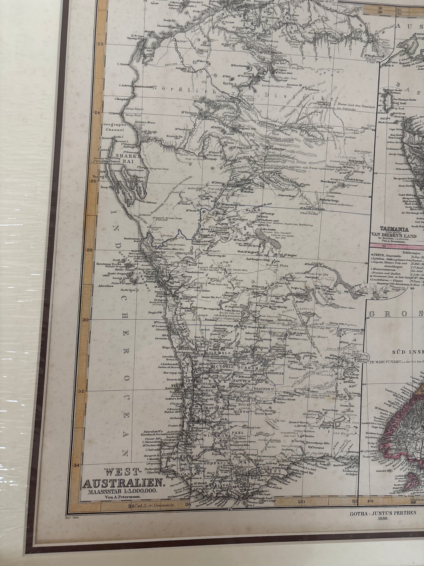
West Australia, New Seeland - Petermann 1880
West Australia, New Seeland - Petermann 1880
Petermann’s Map of Western Australia & New Zealand (1880)
Title: West-Australien [and] Neu-Seeland (New Zealand)
Cartographer: August Petermann
Publisher: Justus Perthes (Gotha)
Origin: Gotha, Germany
Date: 1880
Technique: Steel engraving with original hand-colouring
The Narrative: The Scientific Precision of the Gotha School
This map captures the transition of the South Pacific colonies into modern administrative states. Published by the legendary firm of Justus Perthes, this sheet was edited by August Petermann, one of the most influential geographers of the 19th century. It provides a dual focus: the expanding frontier of West Australia and the fully partitioned provinces of New Zealand.
By 1880, the "Golden Age" of exploration had given way to rigorous scientific survey. This map illustrates the intricate detail of the Swan River Colony and the burgeoning districts around Perth, alongside a comprehensive view of New Zealand’s North and South Islands. It is a document of colonial maturity, showing the railroads, telegraph lines, and goldfields that were reshaping the Southern Hemisphere.
Chronicles of the Map
-
Dual-Region Mastery: The sheet is cleverly divided to show West-Australien on the left and a large-scale rendering of Neu-Seeland on the right, providing a comprehensive overview of two key colonial frontiers.
-
Tasmania Inset: A detailed central inset focuses on Tasmania (Van Diemen’s Land), showing the island's advanced state of settlement and agricultural development.
-
The Isthmus of Auckland: A specialized inset in the lower-right corner provides a detailed topographical view of the Isthmus of Auckland, highlighting the strategic geography of New Zealand's largest city.
-
Petermann’s Signature Style: Known for its incredible density of information, the map features fine-line engraving that captures everything from mountainous relief to the smallest coastal soundings.